

 Spektakularna geografska čuda Evrope – Najznačajnije prirodne znamenitosti">
Plan a sunrise visit to the Swiss Alps to see the peaks glow with first light and photograph serrated silhouettes above pine slopes.
Then travel along Norway’s fjords, where long glacial arms reach toward the sea. A quiet vessel cruise along the water reveals sheer rock faces and cascades that plunge into sheltered inlets.
In Croatia, Plitvice Lakes National Park presents layered terraces with turquoise pools linked by cascades, set among dense woods and a thriving avifauna along the paths.
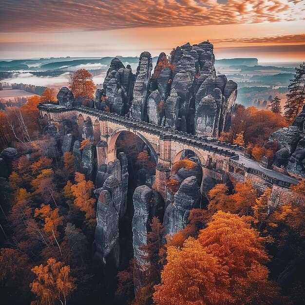
Italy’s Dolomites and the Matterhorn offer alpine panoramas; pyramidal peaks rise above glacial valleys, inviting hikers to plan multi-day routes around high passes.
In Iceland, Gullfoss and nearby geothermal fields show a dynamic mix of ice and steam, while Vatnajökull holds vast ice that feeds rivers across the highlands.
Practical tips: visit early, wear sturdy footwear, and allocate a couple of hours for each site to enjoy clear views and quiet moments.
Gouffre Berger, France: Practical Guide to Exploring Europe’s Deepest Cave
Plan your descent with a licensed guide; youll need a booking and a safety briefing before entering Gouffre Berger. Referred to as Europe’s deepest cave, Gouffre Berger in France’s Isère region offers a completely subterranean world where the interior unfolds through a sequence of shafts and dimly lit galleries. The surface approach is simple, but the exploration inside demands focus, steady rhythm, and respect for the cave’s delicate balance. The scenery above ground remains picturesque, with birds circling above the entrance as you prepare; the underground passages reveal a powerful, great contrast that leaves visitors marveling.
Gear list: helmet with secure chin strap; headlamp with two back-up sources; sturdy boots with grip; a durable harness and rope kit; warm, moisture-wicking layers; a waterproof shell; and a small pack with water and snacks. youll carry a spare light, batteries, and a compact first-aid kit inside. Guides handle fixed lines and anchors; do not improvise. With proper conditioning and rope techniques, the descent to the largest sections can take most of a day; pace yourself and listen to your guide.
The interior features dimly lit galleries, underground lakes, and the constant hum of running water. The route may require wading through shallow pools and careful footwork through slick rock. Falls create echoes that sharpen eyes and contribute to the sense of scale; the space feels powerful yet open and simple in some sections, while hiding complex passage networks elsewhere. Visitors should remain respectful of the environment, keep hands free for rope work, and listen to the guide’s instructions. For some, the textures on mineral formations evoke lascaux-like patterns, a curious link between prehistoric art and modern exploration; marveling at this contrast helps you feel how humans have used cave spaces across the ages.
Getting there: take a train to a nearby French town, then a short bus ride or taxi to the trailhead. A single day trip is common for experienced groups, but many visitors prefer an overnight stay in a nearby village to allow for a calm start and exit before fatigue sets in. The entrance is modest, but the descent below ground is anything but; plan for a full-day schedule, and respect the opening times and safety rules provided by your guide, because the cave is dynamic and weather-dependent. Local guides, including a veteran named lovech, help newcomers with pacing, rope handling, and how to read cave signs.
Location specifics: Gouffre Berger’s geographical setting and access route
Begin with a licensed guide and enter Gouffre Berger only with a full team and proper gear. Inside the limestone cavity, the initial chamber opens into a wide passage and a tall shaft, delivering a spectacle that echoes the drama of the Matterhorn. Just as you step in, keep your headlamp bright and your pace deliberate, and respect fixed lines and rope sections. Padirac and Aggtelek are renowned centers in their own right, but Gouffre Berger centers on technical cave exploration in a way that demands coordinated teamwork and careful planning.
Location specifics: Gouffre Berger sits inside the Vercors limestone massif, within the Isère region of central France. The entrance lies just below a cliff on the plateau’s edge, inside a wooded hillside that frames a karst valley. The cave’s network formed as groundwater flowed through carbonate rock, eroding and expanding passages since the earth cooled. The system includes a deep cavity and a series of canyons and chambers, making it a landmark in European speleology and a full experience for skilled cavers–ahead of other famous examples such as Krubera, Mulino, Altamira, or larger cave complexes that show different karst dynamics.
Access route: Begin at the plateau trailhead above the valley and park at the designated pull-off, then follow a marked path that climbs to a saddle. From there, a short scramble leads down to the entrance; plan a 30–60 minute approach depending on conditions. Enter via the cleft and descend into the main passages with a guide; rope gear is required for vertical sections, and a helmet is mandatory. The longest vertical segments in the network require careful ropework and teamwork. Always check weather before you go, as rainfall can raise water levels below. For a safe, memorable experience, coordinate with a local speleological club, respect the environment, and use the center of your plan to understand how the earth’s flow has shaped these caves for generations.
Access, permits, and booking: steps to arrange a visit
Book online through the official park authority at least six weeks before your visit to secure entry permits and a specific time slot.
In regions like vatnajokull, many routes in protected zones require a guide and a permit; verify the rule for your chosen path with local authorities. If your plan includes a steep descent, ensure the guide is qualified for glacier terrain.
Consult the primary source of information on the park’s site or the national tourism portal to confirm which forms to submit and where to send them.
Lead times vary by season; summer slots fill quickly, so plan six to eight weeks ahead and note group size limits (often 8–12 participants per guide).
Prepare documents and gear; bring government ID, the permit receipt, weather-appropriate clothing, durable boots, a basic first-aid kit, and sun protection. youll want to keep the load light.
On the day, arrive early for check-in, present permits, and listen to the guide’s safety briefing. During the descent or ascent, follow the path markers and respect closures in place where necessary.
If you travel from ireland or majorca, plan buffer days for transfers and consider packages that connect multiple sights; you can align your stay with nearby places and hostels for easy access to the next site. The route often offers powerful scenery and adrenaline moments, with picturesque views that highlight the beauty of the region.
For curious visitors, some routes pass near paleolithic sites and even vilenica cave histories; guides may share greek myths to enrich the experience while you observe rock forms along the gorge.
Seasonal timing and conditions: when to plan your descent
Plan your descent in late spring or early autumn for most sites to balance daylight, weather stability, and crowd levels. For vatnajokull and other glaciers, expect variable wind and rapid weather shifts; this window keeps temps manageable and allows longer sunlit days without mid-summer meltwater floods. If forecasts shift, continue to monitor and adjust plans instead of forcing a descent into a risky slot.
Across the continent, microclimates demand site-specific timing: verdon’s south-facing cliffs warm up fast, target April–June or September–October; lamprechtsofen caves stay accessible with guided slots; capri’s sea-cliff experiences shine in late spring and early autumn when seas calm and suns arc lower for dramatic light. millions of light beams cross crystal walls, making ethereal moments. In borgio, coastal routes respond to wind and tides; in basilicata, pollino trails offer better conditions in May–September; you can continue planning with local guides for maximum safety.
| Site | Best Window (months) | Approx Daylight | Key Conditions | Gear & Access |
|---|---|---|---|---|
| vatnajokull | Mid-June to early September | 14–20 hours peak; wind risk possible | Glacier routes, crevasses, cold temps | First gear: helmet, crampons, ice axe; rope, harness; warm layers; waterproof boots; access requires permit |
| verdon | April–June and Sept–Oct | 12–14 hours in spring; heat possible in summer | Rugged limestone, potential floods in spring, sun exposure | Helmet, sturdy boots, rope systems; access through local guides; caution on wet ledges |
| lamprechtsofen | March–October (tours run year-round with schedules) | 10–12 сати у зависности од осветљења пећине | Етеричне кристалне формације; константна температура пећине ~8–12 C | Кацига, лампа за главу, топли слојеви; резервишите слотове са водичем; пријавите се у канцеларији пећине |
| борђо вереци | April–June and Sept–Oct | 12–16 сати | Приморске литице окренуте ка југу; ветар и стање мора утичу на спуштање | Појас за пењање где је потребно; прслук за спасавање за приобалне стазе; приступ уз локалну дозволу. |
| Капри | Капри | 12–14 сати; услови мора варирају | Погледи на морске литице, трајектне везе; гужве су највеће средином лета | Za morske kajake ili rute po liticama potreban je vodič; lagani pojas; zaštita od sunca |
| полино, басиликата | Мај–септембар | 11–15 сати; пожељна сува сезона | Планинске стазе; време се може брзо променити; дивље животиње | Čvrste čizme, štapovi za planinarenje, mape; dozvola gde je potrebna; pristup preko lokalnih rendžera |
Опрема, тренинг и безбедност: савети за истраживање пећина
Proverite kacigu, naglavnu lampu i rezervne baterije pre svakog spusta; pouzdan izvor svetlosti je od ključnog značaja za podzemne prolaze koji se otkrivaju na dramatične načine.
У влажним деловима, очекујте пливање преко акумулираних језера; понесите водоотпорну торбу за електронику, купаћи костим и резервну одећу. Имајте чврсту обућу са добром тракцијом и држите резервне чарапе у водоотпорној кесици; носите мали пешкир за сушење када изроните.
- Kaciga sa sigurnim remenom za bradu i opcijom vizira, ako je dostupna
- Примарна лампа плус две резервне; водоотпорни комплети батерија и додатне батерије
- Uže ili fiksna linija prikladna za rutu; za početnike, dužina od 20–30 m pokriva mnoge vertikale
- Čvrste speleološke čizme ili planinarske čizme sa dobrim prianjanjem i zaštita za kolena
- Водоотпорне торбе за електронику, документа и додатну одећу
- Топли слој за зимске пећине и лагана јакна за зоне хладног ветра
- Pribor za prvu pomoć, zviždaljka i vodootporna karta ili oflajn navigator
- Merna traka ili uže za merenje širine prolaza, visina i tačaka sidrenja
- Marker traka ili kreda za obeležavanje staze i mala beležnica sa beleškama
Trening bi trebalo da bude praktičan i postepen. Završite priznati kurs bezbednosti u pećinama sa kvalifikovanim vodičem, obavljajte provere u paru i dogovorite se o signalima, vremenu za povratak i procedurama za hitne slučajeve. Vežbajte prvo u suvim delovima, zatim u blago vlažnim područjima i na kraju simulirajte vertikalni spust pod nadzorom. Pre nego što počnete, pregledajte rutu sa svojim vodičem, potvrdite višestruke opcije za izlaz duž rute i postavite realan vremenski okvir za svaki segment. Stvaranje mirnog ritma pomaže vam da upravljate energijom i održite fokus tokom dugog dana u pećini.
Сезонско планирање је важно. Зими, заштитите се од хладне воде и брзих промена температуре; ограничите изложеност и планирајте додатне топле слојеве. Лети, планирајте хидратацију, излагање сунцу пре уласка и пратите умор. Увек имајте план којем потпуно верујете; обавестите сапутнике о свом плану и потврдите га са водичем. У Грузији и другим карстним регијама, време утиче на приступ пећини и ниво воде; прилагодите опрему у складу с тим.
У чувеним местима контекст је важан. Неке пећине се налазе у областима које су на Унесковој листи, а локални прописи могу захтевати дозволе или вођено посећивање. На обали Карвоира, приморске морске пећине захтевају свест о плими и осеци и поштовање ерозије; останите на обележеним стазама да не бисте оштетили осетљиве формације. Пећине попут Ласка нас подсећају да је очаравајућа кроз време, са моћном геологијом и драматичним камењем које привлачи посетиоце и истраживаче. У Грузији, различита окружења пећина позивају на истраживање са искусним водичем који може да измери ризике и пружи савете за безбедност. Заправо, пећине су повезане са древним људским причама, чинећи сваку експедицију кроз време значајним искуством за посетиоце.
Оближње знаменитости и идеје за путовања: проширење вашег плана путовања по европским пећинама
Počnite sa Postojnskom jamom u Sloveniji, za vrlo efikasan uvod dostupan ovde: nešto više od 90 minuta vođene šetnje kroz osvetljene krečnjačke stene koje su dom milionima stalaktita i stalagmita, nakon čega sledi kratka vožnja vozom između dvorana. Taman dovoljno vremena da se uživa u kontrastu.
Након тога, крените на југ до Базиликејте до пећина Пертоса-Аулета, где 60-минутна вожња бродом пролази кроз реку кроз крашки систем; осветљене одаје откривају стене у земљаним тоновима, док сталактити висе попут лампиона са плафона.
У истом региону можете посетити и дивовску пећину (Grotta Gigante) да упоредите размере: узвишену одају са стубовима насталим током милиона година, повезану широким пролазима и светлу, добро осветљену атмосферу.
Затим се пребаците северно на Исланд и истражите ледене пећине испод Ватнајекидла. Замрзнути зидови рефлектују сунчеву светлост у плавим фасетама, а водичи вас воде кроз осветљене тунеле 2–3 сата, истичући највише ледене формације и призор који одузима дах, а то је контраст између земље и леда.
Француска нуди Гуфр де Падирак, најпознатији понор у којем вас лифт спушта у празнину, а чамац плови подземном реком испод стена које блистају у наранџастом и белом светлу. Ова станица се добро слаже с целодневним истраживањем оближњих пећина и подручја Гуфра изнад земље.
На крају, у плану спојите одмор на грчком острву. Грчка обала крије морске пећине између морских литица и увале острва; можете спојити трајекте, кратка путовања бродом и шетње копном да бисте уживали у сунцу на води и крашким облицима који обликују и обалу и пећине.