


Σύσταση: Brief the crew and request updated weather data before entering known turbulence zones; changing altitude into a smoother layer can reduce exposure and protect passenger comfort.
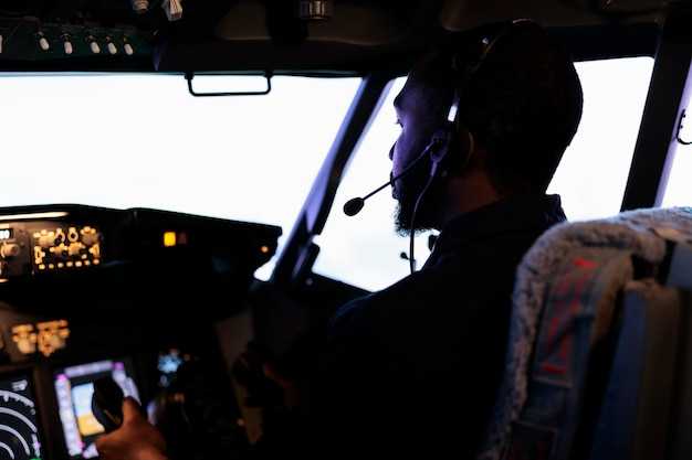
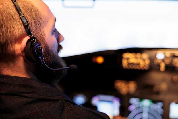
Pilots rely on a mix of signals: PIREPs, SIGMETs and AIRMETs, radar trends, wind-shear indicators, and convection patterns that are known to produce turbulence. Unlike relying on a single signal, the resulting picture improves when cross-checking forecast models with real-time reports from other flights. Severity estimates guide actions at the flight deck and in the cabin, and every crew member contribute to the decision process. Dips and shear zones near jet-stream boundaries often prompt a temporary change in altitude.
Onboard tools translate forecast data into actionable steps. Data links from dispatch feed weather models into the cockpit, while on-board radar and other sensors detect activity that may be invisible from the flight level. Robust communication between the cockpit and dispatch keeps data aligned, and when high-altitude instability appears, crews can climb or descend into a smoother layer; changed flight levels may reduce exposure by thousands of feet, curbing the risk of severe turbulence and resulting passenger discomfort. This approach requires discipline in management but improves overall safety.
Clear communication with cabin crews keeps passengers safe and comfortable. The captain may request belt-sign activation ahead of rough air and coordinate with cabin staff to secure loose items. For small aircraft, the crew adapts by briefings and short, crisp instructions for passengers; for larger jets, they maintain steady cabin management while the flight path adjusts.
Routes around busy airports benefit from proactive planning. Dispatch can propose a route that minimizes exposure to persistent turbulence, and crews use high-altitude forecasts to decide on climbs or descents. This approach, unlike reactive responses, reduces schedule impact while maintaining safety and comfort. In practice, spend a few extra minutes reviewing updated data before cruise, then execute the plan with confidence.
Three Weather Signals to Watch for Turbulence
Identify three signals before take-off and keep them within your mental map for the whole flight. Since pirep from nearby flights and radar echoes can update you on movement in the region, stay informed. These signals were proven helpful in practice; keep yourself prepared to adjust.
Signal 1 – Updrafts and convective towers: Updrafts build sharply near developing storms, causing intense movement in a small region. An example: a cluster of small cumulus cells loft air, and these cells lasted several minutes before fading.
Signal 2 – Wind shear and low-level changes: Low-level wind shear, especially where velocity or direction shifts toward your path, can produce bumps. Sometimes pirep confirms the shift, and movement can project toward your altitude quickly. If you detect this in the briefing, doesnt require panic; you can adjust by changing altitude or speed and, if needed, request an altitude change with ATC.
Signal 3 – Jet stream core and temperature gradient: A strong, sharply defined jet-core region with a significant temperature difference can spark abrupt turbulence even without convective cells. When you approach the edge of the core, expect updrafts toward the center of the route and turbulence that may last for minutes; this is particularly noticeable at higher altitudes and near the region boundary.
| Signal | What to watch | Typical turbulence | Recommended action |
|---|---|---|---|
| Updrafts/convection | Cloud development, radar echoes, pirep reports; movement of small cells; region | Moderate to intense turbulence near the updraft core | Trim, reduce speed if needed, consider altitude change on subsequent fixes |
| Wind shear | Low-level wind shifts, velocity and direction changes along your path; pirep confirms | Sudden bumps; movement toward your altitude can escalate quickly | Adjust altitude or speed; keep seat belt sign on; request altitude change if ATC approves |
| Jet stream/temperature gradient | Strong jet core, inversion-related temperature differences; movement along the jet | Sharp turbulence at core edges; can last several minutes | Climb or descend to avoid core; maintain proper separation from other traffic |
Five Onboard Tools Used for Turbulence Assessment
Begin with a quick check of the onboard weather radar’s turbulence mode to spot pockets of disruption ahead and adjust altitude or flight path before entering them.
-
Weather Radar and Turbulence Detection
The weather radar is built to highlight high-velocity pockets and wind-shear bands. It displays velocity and reflectivity trends, helping you keep the ride smooth and avoid sudden gusts. When you see sharp intensity changes near convective cells, communicate with ATC and consider an altitude or route change to reduce impact on the cabin and passengers.
-
Data-Link Weather Updates
Updates created by meteorological models and recent PIREPs arrive via ACARS or satellite link. The πηγή confirms provenance, so you know which forecast you are using. Use these insights to vary flight levels as needed and keep the seat and passenger experience in mind.
-
Air Data and Velocity/Deviation Monitoring
The air data computer feeds the PFD with velocity (IAS/Mach), vertical speed, and altitude deviation. If the vertical velocity suddenly spikes or the indicated airspeed varies beyond expected, reassess the situation and adjust speed or altitude to maintain stable levels. This tool helps you recognize invisible turbulence and prevents abrupt changes for passengers.
-
Cabin Observations and Passenger Signals
Cabin crew reports and passenger cues provide a practical input set for early turbulence detection. Look for tightened belts, restless movement, and shifts in the cabin near seat rows. Turning on the seat belt signs and guiding passengers to stay seated helps keep the situation controlled and prevents injuries.
-
PIREP and Flight Deck Communication
Direct reports from nearby flights (PIREPs) arrive through the datalink and are called out to crew and ATC. The pilot communicates these insights, and the crew can adjust altitude or speed to avoid the strongest turbulence at the indicated levels. This collaboration reduces the impact on the cabin and supports a smoother ride for every passenger.
Two Classic Wind-Shear Scenarios and Pilot Responses
Recommendation: Initiate a go-around immediately if wind-shear indicators appear on approach; apply TOGA thrust, maintain a nose-up attitude, and climb to a safe altitude while reconfiguring for a smoother intercept on a new route. Log pirep and coordinate with dispatch on revised directions; use predictive weather data to advance your course away from the gust front and stretch the flight path toward calmer air.
Scenario 1: Microburst on final approach
In this classic form of wind shear, a strong downdraft delivers a sharp dips in airspeed and a rapid deviation in your flight path as the gust front moves through moisture-laden air near convective activity. The wind itself gets stronger and can shift from a favorable headwind to a disruptive tailwind, with changes that can be drastically fast within 5-15 seconds and a vertical gust component that can reach thousands of feet per minute. The impact on your approach includes momentary turn away from the landing course and a struggle to maintain the target speed; you may see the aircraft’s track deviation. The corrective response emphasizes decisive action: advance thrust to TOGA, pitch for a positive climb, and retract flaps to the smoother, clean configuration as soon as you are clear of the cell. Re-intercept the approach along a route that offers a more favorable wind direction and reduces exposure to the shear; report pirep to help the next crew and adjust directions in the forecast. This teamwork is common across carriers, with trainings that keep the crew on their toes while their adoptions of these steps contribute to a smoother place for the flight and better handling of the event, backed by the science of weather models and predictive tools used in everyday operations. The moisture in the area often indicates where the gusts will form, so the crew stays alert to possible deviation and keeps the advance of the flight track on a safer course.
Scenario 2: Clear-air or jet-stream wind shear aloft
In this scenario, wind speed and direction change with altitude without visible storms, creating standing waves that stretch across thousands of feet. The shear itself can occur in the jet core and can cause a sharp deviation in your course, with a deviation that can sharply alter your direction if you don’t manage the control inputs. The predictive science behind this wind-shear form relies on radar, weather data, and wind models to forecast the exact place where the shear will lessen; the forecast offers a path to stretch to a smoother layer. The response focuses on altitude and speed management, keeping the wings level and avoiding rapid turns, while you adjust your route away from the strongest gradient and maintain a steady speed that helps you ride the shear with less impact. When possible, pilots hold a consistent direction while awaiting guidance from ATC, minimizing disruption to routes; though the conditions are challenging, a calm, methodical approach reduces risk and preserves flight efficiency. Pirep from the crew informs the science and helps the next flight avoid the most severe pockets. The long-term impact on schedules can be minimized with proactive planning and adherence to the predictive model’s guidance, something airlines like lufthansa incorporate into training to keep their teams ready for these moments. This place-aware approach makes the result smoother for all flights in their routes, and the advance of new data is needed to guide the next flight and respond to the gust, though the challenge remains significant.
Four Practical Flight Techniques to Reduce Turbulence Impact
Technique 1: Predictive routing and altitude selection always check the latest predictive weather data before takeoff and adjust altitude to stay within stable shear layers. In different conditions, small altitude changes can avoid the strongest peaks of turbulence; in winter, jet streams shift, making nearby routes around narita πιο ασταθή. Κάθε σχέδιο πτήσης θα πρέπει να λαμβάνει υπόψη τα προφίλ ανέμου και τα μοτίβα των νεφών. Εάν οι προβλέψεις υποδεικνύουν υψηλότερο κίνδυνο, δημιουργήστε ένα σχέδιο έκτακτης ανάγκης και προσαρμόστε αμέσως τη διαδρομή για να αποφύγετε τα κύτταρα που θα προκαλούσαν ισχυρότερους ριπαίους ανέμους. Η σουίτα αεροηλεκτρονικών που δημιουργήθηκε για αυτόν τον σκοπό είναι κατασκευασμένη για να αποσβένει την ενέργεια και να παρέχει ομαλότερες μεταβάσεις, βοηθώντας στη μείωση στιγμιαίος δυσφορία για τους επιβάτες. Αυτό βοηθά στη διατήρηση του ελέγχου όταν οι αναταράξεις γίνονται απρόβλεπτες και ο στόχος παραμένει η ελαχιστοποίηση της έκθεσης και η διατήρηση της πτήσης εντός προβλέψιμων ενεργειακών ζωνών.
Τεχνική 2: Τεχνική ήπιου ελέγχου για πτήση σε αναταράξεις Όταν εμφανίζονται ριπές, εφαρμόστε μικρές, συνεχείς εντολές ελέγχου αντί για μεγάλους, απότομους ελιγμούς. Αυτή η μειωμένη ώθηση διατηρεί τον συντελεστή φόρτισης εντός ενός στιγμιαίος εύρος και βοηθά στην αποφυγή μιας ξαφνικής ανοδικής ή καθοδικής εκτροπής που είναι ιδιαίτερα άβολος για τους επιβάτες. Εάν συμβεί μια στιγμιαία διάτμηση, διατηρήστε τις πτέρυγες οριζόντιες και χρησιμοποιήστε το πηδάλιο διεύθυνσης συντονισμένα μόνο όταν απαιτείται. Αυτή η προσέγγιση ελαχιστοποιεί την δομική καταπόνηση και διατηρεί την πορεία πτήσης εντός της προγραμματισμένης τροχιάς. Οι ενέργειες απαιτούν ορθή κρίση και θα πρέπει να εκτελούνται εντός καθιερωμένων Τυποποιημένων Διαδικασιών Λειτουργίας (SOP).
Τεχνική 3: Στρατηγική διαχείριση ταχύτητας για την εξασθένηση των αναταράξεων Διατηρήστε την ταχύτητα ελιγμών και σεβαστείτε το βάρος στους τροχούς, προσαρμόζοντας την ταχύτητα πτήσης για να παραμείνετε λίγο μπροστά από τις κορυφές της διάτμησης. Διατηρώντας το συνιστώμενο περιθώριο ταλάντωσης κατά τη διάρκεια μιας καταιγίδας, μειώνετε τις κάθετες επιταχύνσεις που μπορούν να γίνουν αντιληπτές ως τραντάγματα. Το χειμώνα, επιχειρήστε σε ελαφρώς διαφορετικές ταχύτητες για να λάβετε υπόψη τον πυκνότερο αέρα και τις ριπές· αυτή η επιλογή μειώνει την πιθανότητα εισόδου σε ισχυρούς θύλακες. Αυτή η προσέγγιση σας κρατά μακριά από απρόβλεπτα φαινόμενα διάτμησης και θα πρέπει να συντονίζεστε με το τμήμα πτητικών λειτουργιών και την εναέρια κυκλοφορία όταν απαιτείται απόκλιση· εάν η πρόγνωση δείχνει μια περίοδο αστάθειας, σχεδιάστε να μειώσετε αμέσως το υψόμετρο ή να προσαρμόσετε την πορεία για να αποφύγετε τους αναγκαστικούς ελιγμούς από την αεροδυναμική διάτμηση.
Τεχνική 4: Αποφυγή διαδρομής βάσει δεδομένων και συντονισμός πληρώματος Χρησιμοποιήστε ραντάρ καιρού σε πραγματικό χρόνο, δορυφορικά δεδομένα και προγνωστικά μοντέλα για να αποφύγετε περιοχές που παράγουν αόρατη αναταραχή. Επικεντρωθείτε στην αποφυγή όχι μόνο των εμφανών ζωνών καταιγίδων αλλά και των διάχυτων θυλάκων που προκύπτουν από αλληλεπιδράσεις ορεινών κυμάτων ή ψυχρών μετώπων· μόλις εντοπιστεί μια ριπή, ελέγξτε ξανά τη διαδρομή και ενημερώστε αμέσως το πλήρωμα. Προληπτικές τροποποιήσεις διαδρομής κοντά σε narita οι διάδρομοι βοηθούν στην ελαχιστοποίηση της έκθεσης σε απρόβλεπτος τσέπες που δημιουργούνται από εποχιακά φαινόμενα· υπό αυτή την έννοια, χρειάζεται να κάνετε γρήγορες αλλά ταυτόχρονα στοχευμένες κρίσεις για να παραμείνετε σε πορείες ελάχιστης ενέργειας εντός των περιορισμών εναέριου χώρου. Τέτοιες διορθώσεις δεν απαιτούν κατ’ ανάγκη μεγάλες παρακάμψεις, αλλά απαιτούν έγκαιρη κρίση και συντονισμό ακριβείας.
Μία Ανασκόπηση Μετά την Πτήση για τη Βελτίωση της Πρόγνωσης Αναταράξεων
Αμέσως μετά την προσγείωση, πραγματοποιήστε μια ανασκόπηση 10 λεπτών μετά την πτήση για να βελτιώσετε την πρόγνωση των αναταράξεων: βεβαιωθείτε ότι το πλήρωμα καταγράφει την ακολουθία των συναντήσεων με αναταράξεις με χρονικές σημάνσεις και χρόνους των συμβάντων, υψόμετρο, ταχύτητα αέρα και κατάσταση της ένδειξης ζώνης ασφαλείας. Σημειώστε πώς η δεξιότητα και οι παρατηρήσεις του πληρώματος συνέβαλαν στην ασφάλεια. Αυτή η απλή πρακτική προσφέρει μια ώθηση για μάθηση και αποδίδει γρήγορα ενισχύοντας τη σύνδεση μεταξύ των παρατηρούμενων διόδων των θυλάκων αναταράξεων και των προβλεπόμενων αποτελεσμάτων. Κάντε το αυτό πριν παραδώσετε το αεροσκάφος και μοιραστείτε τα ευρήματα για να ενημερώσετε ανάλογα την υπηρεσία διανομής. Βελτιώστε την επικοινωνία κατά την παράδοση επισημαίνοντας τις ενδείξεις που πρέπει να προσέξετε στο επόμενο σκέλος και αναζητήστε μοτίβα στον άνεμο, την οριζόντια διάτμηση, το υψόμετρο και την ταχύτητα.
Μετά την άφιξη, συγκρίνετε τις πραγματικές αναταράξεις με τα προγνωστικά σήματα: αναζητήστε πώς οι πραγματικές ριπές και οι θύλακες ποικίλλουν κατά μήκος μιας πτήσης και εάν οι ίδιες προγνωστικές κυψέλες που προβλέπονται από τη διαδρομή ευθυγραμμίστηκαν με αυτό που νιώσατε και είδατε. Συνδέστε τις παρατηρούμενες διόδους θυλάκων αναταράξεων με μετεωρολογικά προϊόντα όπως ηχώ ραντάρ, ανεμολογικά πεδία, METAR και SIGMET, και σημειώστε τις χρονικές σφραγίδες και τις ζώνες υψομέτρου. Τεκμηριώστε τα οριζόντια φαινόμενα διάτμησης και τυχόν τοπικούς δείκτες μεταφοράς θερμότητας. Αυτή η συσχέτιση βοηθά τις ομάδες πρόγνωσης να προσαρμόσουν γρήγορα και ανάλογα τις εισροές, μειώνοντας σημαντικά τους ψευδείς συναγερμούς και βελτιώνοντας την αξιοπιστία για τους υπόλοιπους τομείς.
Καθορίστε ρόλους για την ενημέρωση μετά την πτήση: ο κυβερνήτης ηγείται, ο συγκυβερνήτης καταγράφει και το πλήρωμα καμπίνας παρέχει αναφορές όταν είναι σχετικές. Κάθε μέλος πληρώματος συνεισφέρει ο ίδιος στη συζήτηση για να εξισορροπήσει την προσεκτική αξιολόγηση με την πρακτική δράση. Υπενθυμίστε στην ομάδα να προσδεθεί κατά τη διάρκεια τμημάτων αναταράξεων και να κρατάει τις ζώνες ασφαλείας δεμένες όπως χρειάζεται στην επόμενη πτήση. Διατηρήστε τη συνεδρία σύντομη: 5–7 λεπτά, με ένα σαφές συμπέρασμα για την επόμενη πτήση. Η ίδια ρουτίνα, επαναλαμβανόμενη μετά από κάθε σκέλος, χτίζει αξιοπιστία και γρήγορη λήψη αποφάσεων.
Μετατροπή ευρημάτων σε δράση: δημιουργήστε μια σύντομη αναφορά 4 σημείων που το επόμενο πλήρωμα μπορεί να χρησιμοποιήσει εκ νέου: τοποθεσία και ώρα, παρατηρούμενος μηχανισμός (κατακόρυφη διάτμηση ανέμου, ενδείκτες μεταφοράς), έξοδος πρόγνωσης και προτεινόμενες προσαρμογές. Αυτού του είδους η ανασκόπηση μπορεί να συμβάλει στην εκμάθηση και την καλύτερη ευθυγράμμιση των προβλέψεων. Βεβαιωθείτε ότι το επόμενο σκέλος χρησιμοποιεί ενημερωμένες εκτιμήσεις ανεμολογικού πεδίου και καθοδήγηση ραντάρ. κυκλοφορήστε ώστε να φτάσει στις τοπικές επιχειρήσεις και αποστείλετε ανάλογα. Κάθε ενημέρωση υποστηρίζει την επικοινωνία και μια ισορροπημένη προσέγγιση στον κίνδυνο αναταράξεων.