


ምኽሪ ፦ Brief the crew and request updated weather data before entering known turbulence zones; changing altitude into a smoother layer can reduce exposure and protect passenger comfort.
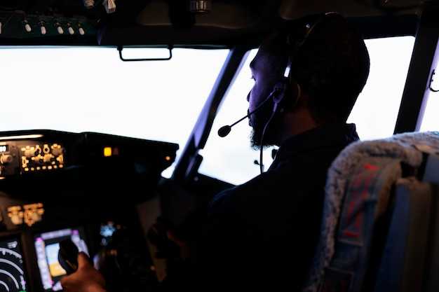
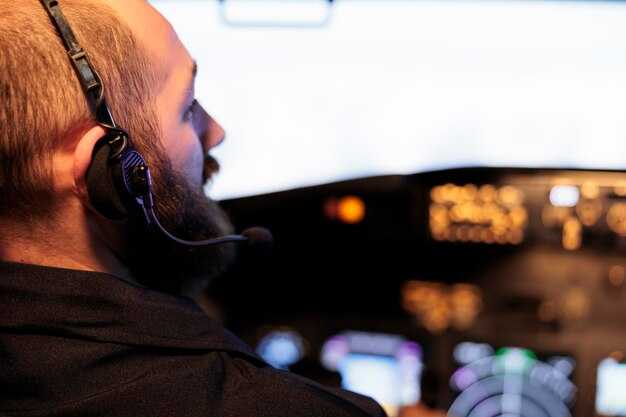
Pilots rely on a mix of signals: PIREPs, SIGMETs and AIRMETs, radar trends, wind-shear indicators, and convection patterns that are known to produce turbulence. Unlike relying on a single signal, the resulting picture improves when cross-checking forecast models with real-time reports from other flights. Severity estimates guide actions at the flight deck and in the cabin, and every crew member contribute to the decision process. Dips and shear zones near jet-stream boundaries often prompt a temporary change in altitude.
Onboard tools translate forecast data into actionable steps. Data links from dispatch feed weather models into the cockpit, while on-board radar and other sensors detect activity that may be invisible from the flight level. Robust communication between the cockpit and dispatch keeps data aligned, and when high-altitude instability appears, crews can climb or descend into a smoother layer; changed flight levels may reduce exposure by thousands of feet, curbing the risk of severe turbulence and resulting passenger discomfort. This approach requires discipline in management but improves overall safety.
Clear communication with cabin crews keeps passengers safe and comfortable. The captain may request belt-sign activation ahead of rough air and coordinate with cabin staff to secure loose items. For small aircraft, the crew adapts by briefings and short, crisp instructions for passengers; for larger jets, they maintain steady cabin management while the flight path adjusts.
Routes around busy airports benefit from proactive planning. Dispatch can propose a route that minimizes exposure to persistent turbulence, and crews use high-altitude forecasts to decide on climbs or descents. This approach, unlike reactive responses, reduces schedule impact while maintaining safety and comfort. In practice, spend a few extra minutes reviewing updated data before cruise, then execute the plan with confidence.
Three Weather Signals to Watch for Turbulence
Identify three signals before take-off and keep them within your mental map for the whole flight. Since pirep from nearby flights and radar echoes can update you on movement in the region, stay informed. These signals were proven helpful in practice; keep yourself prepared to adjust.
Signal 1 – Updrafts and convective towers: Updrafts build sharply near developing storms, causing intense movement in a small region. An example: a cluster of small cumulus cells loft air, and these cells lasted several minutes before fading.
Signal 2 – Wind shear and low-level changes: Low-level wind shear, especially where velocity or direction shifts toward your path, can produce bumps. Sometimes pirep confirms the shift, and movement can project toward your altitude quickly. If you detect this in the briefing, doesnt require panic; you can adjust by changing altitude or speed and, if needed, request an altitude change with ATC.
Signal 3 – Jet stream core and temperature gradient: A strong, sharply defined jet-core region with a significant temperature difference can spark abrupt turbulence even without convective cells. When you approach the edge of the core, expect updrafts toward the center of the route and turbulence that may last for minutes; this is particularly noticeable at higher altitudes and near the region boundary.
| ምልክት | What to watch | Typical turbulence | ቅድሚያ ሊሰጠው የሚገባ ተግባር |
|---|---|---|---|
| Updrafts/convection | Cloud development, radar echoes, pirep reports; movement of small cells; region | Moderate to intense turbulence near the updraft core | Trim, reduce speed if needed, consider altitude change on subsequent fixes |
| Wind shear | Low-level wind shifts, velocity and direction changes along your path; pirep confirms | Sudden bumps; movement toward your altitude can escalate quickly | Adjust altitude or speed; keep seat belt sign on; request altitude change if ATC approves |
| Jet stream/temperature gradient | Strong jet core, inversion-related temperature differences; movement along the jet | Sharp turbulence at core edges; can last several minutes | Climb or descend to avoid core; maintain proper separation from other traffic |
Five Onboard Tools Used for Turbulence Assessment
Begin with a quick check of the onboard weather radar’s turbulence mode to spot pockets of disruption ahead and adjust altitude or flight path before entering them.
-
Weather Radar and Turbulence Detection
The weather radar is built to highlight high-velocity pockets and wind-shear bands. It displays velocity and reflectivity trends, helping you keep the ride smooth and avoid sudden gusts. When you see sharp intensity changes near convective cells, communicate with ATC and consider an altitude or route change to reduce impact on the cabin and passengers.
-
Data-Link Weather Updates
Updates created by meteorological models and recent PIREPs arrive via ACARS or satellite link. The источник confirms provenance, so you know which forecast you are using. Use these insights to vary flight levels as needed and keep the seat and passenger experience in mind.
-
Air Data and Velocity/Deviation Monitoring
The air data computer feeds the PFD with velocity (IAS/Mach), vertical speed, and altitude deviation. If the vertical velocity suddenly spikes or the indicated airspeed varies beyond expected, reassess the situation and adjust speed or altitude to maintain stable levels. This tool helps you recognize invisible turbulence and prevents abrupt changes for passengers.
-
Cabin Observations and Passenger Signals
Cabin crew reports and passenger cues provide a practical input set for early turbulence detection. Look for tightened belts, restless movement, and shifts in the cabin near seat rows. Turning on the seat belt signs and guiding passengers to stay seated helps keep the situation controlled and prevents injuries.
-
PIREP and Flight Deck Communication
Direct reports from nearby flights (PIREPs) arrive through the datalink and are called out to crew and ATC. The pilot communicates these insights, and the crew can adjust altitude or speed to avoid the strongest turbulence at the indicated levels. This collaboration reduces the impact on the cabin and supports a smoother ride for every passenger.
Two Classic Wind-Shear Scenarios and Pilot Responses
Recommendation: Initiate a go-around immediately if wind-shear indicators appear on approach; apply TOGA thrust, maintain a nose-up attitude, and climb to a safe altitude while reconfiguring for a smoother intercept on a new route. Log pirep and coordinate with dispatch on revised directions; use predictive weather data to advance your course away from the gust front and stretch the flight path toward calmer air.
Scenario 1: Microburst on final approach
In this classic form of wind shear, a strong downdraft delivers a sharp dips in airspeed and a rapid deviation in your flight path as the gust front moves through moisture-laden air near convective activity. The wind itself gets stronger and can shift from a favorable headwind to a disruptive tailwind, with changes that can be drastically fast within 5-15 seconds and a vertical gust component that can reach thousands of feet per minute. The impact on your approach includes momentary turn away from the landing course and a struggle to maintain the target speed; you may see the aircraft’s track deviation. The corrective response emphasizes decisive action: advance thrust to TOGA, pitch for a positive climb, and retract flaps to the smoother, clean configuration as soon as you are clear of the cell. Re-intercept the approach along a route that offers a more favorable wind direction and reduces exposure to the shear; report pirep to help the next crew and adjust directions in the forecast. This teamwork is common across carriers, with trainings that keep the crew on their toes while their adoptions of these steps contribute to a smoother place for the flight and better handling of the event, backed by the science of weather models and predictive tools used in everyday operations. The moisture in the area often indicates where the gusts will form, so the crew stays alert to possible deviation and keeps the advance of the flight track on a safer course.
Scenario 2: Clear-air or jet-stream wind shear aloft
In this scenario, wind speed and direction change with altitude without visible storms, creating standing waves that stretch across thousands of feet. The shear itself can occur in the jet core and can cause a sharp deviation in your course, with a deviation that can sharply alter your direction if you don’t manage the control inputs. The predictive science behind this wind-shear form relies on radar, weather data, and wind models to forecast the exact place where the shear will lessen; the forecast offers a path to stretch to a smoother layer. The response focuses on altitude and speed management, keeping the wings level and avoiding rapid turns, while you adjust your route away from the strongest gradient and maintain a steady speed that helps you ride the shear with less impact. When possible, pilots hold a consistent direction while awaiting guidance from ATC, minimizing disruption to routes; though the conditions are challenging, a calm, methodical approach reduces risk and preserves flight efficiency. Pirep from the crew informs the science and helps the next flight avoid the most severe pockets. The long-term impact on schedules can be minimized with proactive planning and adherence to the predictive model’s guidance, something airlines like lufthansa incorporate into training to keep their teams ready for these moments. This place-aware approach makes the result smoother for all flights in their routes, and the advance of new data is needed to guide the next flight and respond to the gust, though the challenge remains significant.
Four Practical Flight Techniques to Reduce Turbulence Impact
Technique 1: Predictive routing and altitude selection always check the latest predictive weather data before takeoff and adjust altitude to stay within stable shear layers. In different conditions, small altitude changes can avoid the strongest peaks of turbulence; in winter, jet streams shift, making nearby routes around narita more volatile. Each flight plan should consider wind profiles and cloud patterns; if forecasts indicate a higher risk, create a contingency and adjust the route immediately to avoid cells that would force larger gusts. The suite of avionics created for this purpose is made to dampen energy and provide smoother transitions, helping to reduce momentary discomfort for passengers. This helps keep control when turbulence becomes unpredictable, and the goal remains to minimize exposure and keep the ride within predictable energy bands.
Technique 2: Gentle control technique to ride turbulence When gusts appear, apply small, continuous control inputs rather than large, abrupt maneuvers. This reduced impulse keeps the load factor within a momentary range and helps prevent a sudden nose-up or nose-down excursion that is especially uncomfortable for passengers. If a momentary shear occurs, maintain wings level and use coordinated rudder only as required; this approach minimizes structural stress and keeps the flight path within planned track. Actions require sound judgment and should be executed within established SOPs.
Technique 3: Strategic speed management to dampen turbulence Maintain maneuvering speed and respect weight on wheels, adjusting airspeed to stay just ahead of the peaks of shear. By keeping within the recommended buffet margin during a storm, you reduce vertical accelerations that can be felt as jerks. In winter, operate at slightly different speeds to account for thicker air and gusts; this choice reduces the chance of entering strong pockets. This approach keeps you away from unpredictable shear events and you should coordinate with dispatch and air traffic when a deviation is required; if the forecast shows a spell of instability, plan to reduce altitude or adjust course immediately to stay clear of forced maneuvers by wind shear.
Technique 4: Data-driven route avoidance and crew coordination Use real-time weather radar, satellite data, and predictive models to steer clear of cells that produce invisible turbulence. Focus on avoiding not just obvious thunderstorm zones but also diffuse pockets that arise from mountain wave or cold-front interactions; once a gust is detected, recheck the route and inform the crew immediately. Proactive route edits near narita corridors help minimize exposure to unpredictable pockets created by seasonal patterns; in that sense, you have to make quick yet deliberate judgments to stay on minimum energy paths within airspace constraints. Such edits do not necessarily require long detours, but they do require timely judgment and precise coordination.
One Post-Flight Review to Improve Turbulence Forecasting
Immediately after landing, run a 10-minute post-flight review to improve turbulence forecasting: ensure the crew records the sequence of turbulence encounters with time stamps and times of the events, altitude, airspeed, and seat belt sign status. Note how the crew’s skill and observations contributed to safety. This simple practice offers a stretch for learning and pays back quickly by strengthening the link between observed passes of turbulent pockets and forecast outputs. Do this before releasing the aircraft, and share findings to reach dispatch accordingly. Improve communication during the handoff by highlighting the cues to watch for on the next leg, and look for patterns in wind, horizontal shear, altitude, and speed.
After arrival, compare actual turbulence with forecast signals: look for how actual gusts and pockets vary along a leg and whether the same forecast cells predicted by the route aligned with what you felt and saw. Link observed passes of turbulent pockets to weather products such as radar echoes, wind fields, METARs, and SIGMETs, and note the time stamps and altitude bands. Document horizontal shear events and any local convection indicators. This correlation helps forecast teams adjust inputs quickly and accordingly, significantly reducing false alarms and improving reliability for the remaining sectors.
Assign roles for the post-flight debrief: captain leads, first officer documents, and cabin crew provide reports when relevant. Each crew member contributes themselves to the discussion to balance cautious assessment with practical action. Remind the team to fasten during segments of turbulence and to keep seat belts fastened as needed on the next leg. Keep the session tight: 5–7 minutes, with a clear takeaway for the next leg. The same routine, repeated after each sector, builds reliability and quick decision making.
Turn findings into action: create a brief 4-point report that the next crew can reuse: location and time, observed mechanism (wind shear, convection indicators), forecast output, and recommended adjustments. This kind of review can contribute to learning and to better forecast alignment. Ensure the next leg uses updated wind-field estimates and radar guidance; circulate to reach local operations and dispatch accordingly. Each update supports communication and a balanced approach to turbulence risk.