


Doporučení: Brief the crew and request updated weather data before entering known turbulence zones; changing altitude into a smoother layer can reduce exposure and protect passenger comfort.
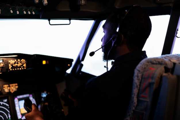
Pilots rely on a mix of signals: PIREPs, SIGMETs and AIRMETs, radar trends, wind-shear indicators, and convection patterns that are known to produce turbulence. Unlike relying on a single signal, the resulting picture improves when cross-checking forecast models with real-time reports from other flights. Severity estimates guide actions at the flight deck and in the cabin, and every crew member contribute to the decision process. Dips and shear zones near jet-stream boundaries often prompt a temporary change in altitude.
Onboard tools translate forecast data into actionable steps. Data links from dispatch feed weather models into the cockpit, while on-board radar and other sensors detect activity that may be invisible from the flight level. Robust komunikace between the cockpit and dispatch keeps data aligned, and when high-altitude instability appears, crews can climb or descend into a smoother layer; changed flight levels may reduce exposure by thousands of feet, curbing the risk of severe turbulence and resulting passenger discomfort. This approach requires discipline in management but improves overall safety.
Clear communication with cabin crews keeps passengers safe and comfortable. The captain may request belt-sign activation ahead of rough air and coordinate with cabin staff to secure loose items. For small aircraft, the crew adapts by briefings and short, crisp instructions for passengers; for larger jets, they maintain steady cabin management while the flight path adjusts.
Routes around busy airports benefit from proactive planning. Dispatch can propose a route that minimizes exposure to persistent turbulence, and crews use high-altitude forecasts to decide on climbs or descents. This approach, unlike reactive responses, reduces schedule impact while maintaining safety and comfort. In practice, spend a few extra minutes reviewing updated data before cruise, then execute the plan with confidence.
Three Weather Signals to Watch for Turbulence
Identify three signals before take-off and keep them within your mental map for the whole flight. Since pirep from nearby flights and radar echoes can update you on movement in the region, stay informed. These signals were proven helpful in practice; keep yourself prepared to adjust.
Signal 1 – Updrafts and convective towers: Updrafts build sharply near developing storms, causing intense movement in a small region. An example: a cluster of small cumulus cells loft air, and these cells lasted several minutes before fading.
Signal 2 – Wind shear and low-level changes: Low-level wind shear, especially where velocity or direction shifts toward your path, can produce bumps. Sometimes pirep confirms the shift, and movement can project toward your altitude quickly. If you detect this in the briefing, doesnt require panic; you can adjust by changing altitude or speed and, if needed, request an altitude change with ATC.
Signal 3 – Jet stream core and temperature gradient: A strong, sharply defined jet-core region with a significant temperature difference can spark abrupt turbulence even without convective cells. When you approach the edge of the core, expect updrafts toward the center of the route and turbulence that may last for minutes; this is particularly noticeable at higher altitudes and near the region boundary.
| Signál | What to watch | Typical turbulence | Doporučená akce |
|---|---|---|---|
| Updrafts/convection | Cloud development, radar echoes, pirep reports; movement of small cells; region | Moderate to intense turbulence near the updraft core | Trim, reduce speed if needed, consider altitude change on subsequent fixes |
| Wind shear | Low-level wind shifts, velocity and direction changes along your path; pirep confirms | Sudden bumps; movement toward your altitude can escalate quickly | Adjust altitude or speed; keep seat belt sign on; request altitude change if ATC approves |
| Jet stream/temperature gradient | Strong jet core, inversion-related temperature differences; movement along the jet | Sharp turbulence at core edges; can last several minutes | Climb or descend to avoid core; maintain proper separation from other traffic |
Five Onboard Tools Used for Turbulence Assessment
Begin with a quick check of the onboard weather radar’s turbulence mode to spot pockets of disruption ahead and adjust altitude or flight path before entering them.
-
Weather Radar and Turbulence Detection
The weather radar is built to highlight high-velocity pockets and wind-shear bands. It displays velocity and reflectivity trends, helping you keep the ride smooth and avoid sudden gusts. When you see sharp intensity changes near convective cells, communicate with ATC and consider an altitude or route change to reduce impact on the cabin and passengers.
-
Data-Link Weather Updates
Updates created by meteorological models and recent PIREPs arrive via ACARS or satellite link. The источник confirms provenance, so you know which forecast you are using. Use these insights to vary flight levels as needed and keep the seat and passenger experience in mind.
-
Air Data and Velocity/Deviation Monitoring
The air data computer feeds the PFD with velocity (IAS/Mach), vertical speed, and altitude deviation. If the vertical velocity suddenly spikes or the indicated airspeed varies beyond expected, reassess the situation and adjust speed or altitude to maintain stable levels. This tool helps you recognize invisible turbulence and prevents abrupt changes for passengers.
-
Cabin Observations and Passenger Signals
Cabin crew reports and passenger cues provide a practical input set for early turbulence detection. Look for tightened belts, restless movement, and shifts in the cabin near seat rows. Turning on the seat belt signs and guiding passengers to stay seated helps keep the situation controlled and prevents injuries.
-
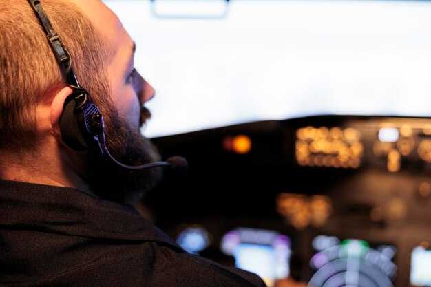
PIREP and Flight Deck Communication
Direct reports from nearby flights (PIREPs) arrive through the datalink and are called out to crew and ATC. The pilot communicates these insights, and the crew can adjust altitude or speed to avoid the strongest turbulence at the indicated levels. This collaboration reduces the impact on the cabin and supports a smoother ride for every passenger.
Two Classic Wind-Shear Scenarios and Pilot Responses
Recommendation: Initiate a go-around immediately if wind-shear indicators appear on approach; apply TOGA thrust, maintain a nose-up attitude, and climb to a safe altitude while reconfiguring for a smoother intercept on a new route. Log pirep and coordinate with dispatch on revised directions; use predictive weather data to advance your course away from the gust front and stretch the flight path toward calmer air.
Scenario 1: Microburst on final approach
In this classic form of wind shear, a strong downdraft delivers a sharp dips in airspeed and a rapid deviation in your flight path as the gust front moves through moisture-laden air near convective activity. The wind itself gets stronger and can shift from a favorable headwind to a disruptive tailwind, with changes that can be drastically fast within 5-15 seconds and a vertical gust component that can reach thousands of feet per minute. The impact on your approach includes momentary turn away from the landing course and a struggle to maintain the target speed; you may see the aircraft’s track deviation. The corrective response emphasizes decisive action: advance thrust to TOGA, pitch for a positive climb, and retract flaps to the smoother, clean configuration as soon as you are clear of the cell. Re-intercept the approach along a route that offers a more favorable wind direction and reduces exposure to the shear; report pirep to help the next crew and adjust directions in the forecast. This teamwork is common across carriers, with trainings that keep the crew on their toes while their adoptions of these steps contribute to a smoother place for the flight and better handling of the event, backed by the science of weather models and predictive tools used in everyday operations. The moisture in the area often indicates where the gusts will form, so the crew stays alert to possible deviation and keeps the advance of the flight track on a safer course.
Scenario 2: Clear-air or jet-stream wind shear aloft
In this scenario, wind speed and direction change with altitude without visible storms, creating standing waves that stretch across thousands of feet. The shear itself can occur in the jet core and can cause a sharp deviation in your course, with a deviation that can sharply alter your direction if you don’t manage the control inputs. The predictive science behind this wind-shear form relies on radar, weather data, and wind models to forecast the exact place where the shear will lessen; the forecast offers a path to stretch to a smoother layer. The response focuses on altitude and speed management, keeping the wings level and avoiding rapid turns, while you adjust your route away from the strongest gradient and maintain a steady speed that helps you ride the shear with less impact. When possible, pilots hold a consistent direction while awaiting guidance from ATC, minimizing disruption to routes; though the conditions are challenging, a calm, methodical approach reduces risk and preserves flight efficiency. Pirep from the crew informs the science and helps the next flight avoid the most severe pockets. The long-term impact on schedules can be minimized with proactive planning and adherence to the predictive model’s guidance, something airlines like lufthansa incorporate into training to keep their teams ready for these moments. This place-aware approach makes the result smoother for all flights in their routes, and the advance of new data is needed to guide the next flight and respond to the gust, though the challenge remains significant.
Four Practical Flight Techniques to Reduce Turbulence Impact
Technique 1: Predictive routing and altitude selection always check the latest predictive weather data before takeoff and adjust altitude to stay within stable shear layers. In different conditions, small altitude changes can avoid the strongest peaks of turbulence; in winter, jet streams shift, making nearby routes around narita více volatilní. Každý letový plán by měl zohledňovat profily větru a oblačnosti; pokud předpovědi naznačují vyšší riziko, vytvořte pohotovostní plán a okamžitě upravte trasu, abyste se vyhnuli buňkám, které by způsobily větší poryvy. Sada avioniky vytvořená pro tento účel je vyrobena tak, aby tlumila energii a poskytovala plynulejší přechody, což pomáhá snižovat momentální nepohodlí pro cestující. To pomáhá udržet kontrolu, když se turbulence stanou nepředvídatelnými, a cílem zůstává minimalizovat expozici a udržet jízdu v rámci předvídatelných energetických pásem.
Technika 2: Technika jemného ovládání pro jízdu v turbulencích Když se objeví poryvy, používejte malé, plynulé zásahy do řízení namísto velkých, náhlých manévrů. Tento snížený impuls udržuje zatížení v rozmezí momentální rozsah a pomáhá předcházet náhlému vychýlení nahoru nebo dolů, které je obzvláště nepříjemný pro cestující. Pokud dojde k momentálnímu střihu větru, udržujte křídla vodorovně a používejte koordinované řízení směrovky pouze podle potřeby; tento postup minimalizuje strukturální namáhání a udržuje letovou dráhu v plánované trase. Akce vyžadují správný rozsudek a měly by být prováděny v souladu se zavedenými standardními operačními postupy (SOP).
Technika 3: Strategické řízení rychlosti pro tlumení turbulencí Dodržujte manévrovací rychlost a respektujte váhu na kolech, upravujte rychlost letu tak, abyste zůstali těsně před vrcholy střihu větru. Dodržováním doporučené rezervy třepání během bouře snižujete vertikální zrychlení, která mohou být pociťována jako trhnutí. V zimě leťte mírně odlišnými rychlostmi, abyste zohlednili hustší vzduch a poryvy větru; tato volba snižuje pravděpodobnost vstupu do silných vzduchových kapes. Tento přístup vás udrží mimo nepředvídatelné události střihu větru a měli byste koordinovat s dispečinkem a řízením letového provozu, když je vyžadována odchylka; pokud předpověď ukazuje období nestability, plánujte okamžité snížení nadmořské výšky nebo úpravu kurzu, abyste se vyhnuli vynuceným manévrům vlivem střihu větru.
Technika 4: Vyhýbání se trasám na základě dat a koordinace posádky Použijte radar počasí v reálném čase, satelitní data a prediktivní modely, abyste se vyhnuli buňkám, které produkují neviditelné turbulence. Zaměřte se na vyhýbání se nejen zjevným bouřkovým zónám, ale také difúzním kapsám, které vznikají v důsledku interakcí horských vln nebo studených front; jakmile je detekován poryv, znovu zkontrolujte trasu a okamžitě informujte posádku. Proaktivní úpravy trasy v blízkosti narita chodby pomáhají minimalizovat vystavení nepředvídatelný kapsy vytvořené sezónními vzorci; v tomto smyslu musíte provádět rychlé, ale promyšlené úsudky, abyste se udrželi na dráhách s minimální energií v rámci omezení vzdušného prostoru. Takové úpravy nemusí nutně vyžadovat dlouhé objížďky, ale vyžadují včasný úsudek a přesnou koordinaci.
Jedna zpráva po letu ke zlepšení předpovědi turbulencí
Bezprostředně po přistání proveďte 10minutový porevizní přehled letu pro zlepšení předpovědi turbulencí: zajistěte, aby posádka zaznamenala sled setkání s turbulencemi s časovými razítky a časy událostí, výšku, rychlost letu a stav signalizace bezpečnostních pásů. Všimněte si, jak dovednosti a postřehy posádky přispěly k bezpečnosti. Tato jednoduchá praxe nabízí prostor pro učení a rychle se vrací posílením vazby mezi pozorovanými průchody turbulentními kapsami a výstupy předpovědí. Udělejte to před uvolněním letadla a sdílejte zjištění, abyste podle toho kontaktovali dispečink. Zlepšete komunikaci během předávání tím, že zdůrazníte signály, na které si dát pozor v dalším úseku, a hledejte vzorce ve větru, horizontálním střihu, výšce a rychlosti.
Po příletu porovnejte skutečné turbulence s předpovídanými signály: sledujte, jak se skutečné poryvy a kapsy liší podél úseku letu a zda se stejné předpovídané buňky trasy shodovaly s tím, co jste cítili a viděli. Propojte pozorované průlety turbulentními kapsami s meteorologickými produkty, jako jsou radarové odrazy, větrná pole, METAR a SIGMET, a poznamenejte si časová razítka a výšková pásma. Dokumentujte události horizontálního střihu větru a případné lokální indikátory konvekce. Tato korelace pomáhá týmům předpovědi rychle a odpovídajícím způsobem upravit vstupy, což výrazně snižuje počet falešných poplachů a zlepšuje spolehlivost pro zbývající sektory.
Přiřaďte role pro rozbor po letu: kapitán vede, první důstojník dokumentuje a palubní personál poskytuje zprávy, když je to relevantní. Každý člen posádky sám přispívá do diskuze, aby se vyvážilo opatrné hodnocení s praktickým jednáním. Připomeňte týmu, aby se během úseků turbulence připoutal a aby měl bezpečnostní pásy zapnuté podle potřeby i v dalším úseku letu. Udržujte krátké trvání sezení: 5–7 minut, s jasným závěrem pro další úsek letu. Stejná rutina, opakovaná po každém sektoru, buduje spolehlivost a rychlé rozhodování.
Převeďte zjištění do akce: vytvořte stručnou zprávu o 4 bodech, kterou může další posádka znovu použít: poloha a čas, pozorovaný mechanismus (střih větru, indikátory konvekce), výstup předpovědi a doporučené úpravy. Tento typ revize může přispět k učení a lepšímu sladění předpovědí. Zajistěte, aby následující úsek používal aktualizované odhady větrného pole a radarové navádění; rozšiřte je tak, aby se dostaly k místním operacím a dispečinku. Každá aktualizace podporuje komunikaci a vyvážený přístup k riziku turbulence.