


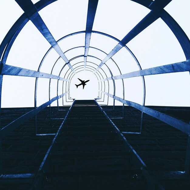
SXMdan adrenalin: Princess Juliana xalqaro aeroporti, bu yerda samolyotlar Maho plyaji ustidan pastlab uchib o'tadi va tomoshabinlar samolyotning havo oqimida turtkilanishlarni his qilishadi, olomon yaqin atrofdagi plyajlarga yoyiladi - 2025-yilgi ajoyib qo'nishlar uchun debocha.
Mutaxassislar ekstremal sozlamalarni amaliy foydalanish imkoniyati bilan muvozanatlashtiradigan saralangan to'plamni ta'kidlashmoqda. Lukla, bir narsaga qo'nib olgan Gimalay togʻ yonbagʻri vodiydan esayotgan erta tonggi shamollarni qarshi oladi. Paro Butanda ibodat bayroqlari va ibodatxona tepaliklari bilan o'ralgan vodiyga yondashuv taklif etiladi. Barra‘Shotlandiyadagi plyaj aerodromi faqatgina suv qaytgandagi oynalarda ishlaydi, bu siz hech qachon unutmaydigan tajriba. Innsbruk qor bilan qoplangan cho'qqilarga tiraladi, ayni paytda Funshal Madeyraga kelayotganda, dengiz purkagichlari bilan to'ldirilgan qoyalar chiroyli manzara yaratadi.
Sayohatchilar uchun mahalliy suv toshqinlari va shamollar bilan rejalashtirilgan oynalar - Barraning suv toshqini jadvali, Luklaning ertalabki termallari va Paroning tor vodiy oynalari. Agar Sizda cheklangan vaqt, ikkita manzilni birlashtiring: SXM yuksak energiya bilan qirg'oq bo'ylab yugurish uchun va Innsbruk alp togʻlari manzarasi uchun. Sayohat qilish light bir nechta manzilga mo'ljallangan marshrutlar orasida harakatlanishingizga yordam beradi.
Bunda Kirish 2025-yilgi tanlovlar uchun ekspertlar amaliy maslahatlar bilan bo'lishadi: ertalabki joylarni bron qiling, suv qaytish jadvallarini tekshiring Barra, va shamol ogohlantirishlarini kuzatib boring. Dramaning katta qismi soat sayin oʻzgarib turadigan shamol yoʻnalishidan kelib chiqadi; g'arbga qarab Parvozlar ko'pincha Atlantika okeani ustidan aniqroq manzaralarni ochib beradi, tog'li hududlarga yaqinlashish esa shamollarga hurmat talab qiladi. Shunga qaramay, mukofot - bu hayratlanarli: balandlik, tezlik va atrof-muhit manzaralarini aks ettiruvchi fotosuratlar.
Sent-Morits Keysi Stedisi: Engadin/Samedan Aeroporti uchun Amaliy Qo'nish Tafsilotlari
Alp tog'lari ustida kutilmagan hodisalardan qochish uchun oldindan 3 graduslik yakuniy yondashuvni rejalashtiring va NOTAMlarni tekshiring. Ushbu yondashuv, aniq bajarilganda, ekipajlarga samolyotni atrofdagi cho'qqilar ustida saqlab turgan holda, ixcham uchish-qo'nish yo'lagidagi tegish zonasida qo'nishga imkon beradi.
Engadin/Samedanning uchish-qo‘nish yo‘lagi taxminan 1800 metrga cho‘zilgan va dengiz sathidan 1707 metr balandlikda joylashgan, bu esa dvigatel unumdorligini pasaytiradi va qo‘nish ko‘rsatkichlariga ta’sir qiladi. Yakuniy qism tezlikni ehtiyotkorlik bilan boshqarishni, barqaror konfiguratsiyani va qisqa uchish-qo‘nish yo‘lagida xavfsiz qo‘nishni ta’minlash uchun 50 fut balandlikda qaror qabul qilishni talab qiladi.
Yuk tashuvchilar va rampalarga xizmat ko'rsatuvchi ekipajlar bilan yer usti xizmatlarini muvofiqlashtiring, shunda yuk va yo'lovchilar oqimi muammosiz bo'ladi. London yoki Shvetsiyadan kelayotgan mehmonlarga eksklyuziv transfer variantlarini va Engadin vodiysining merosini yoritib beruvchi video brifing taklif qiling. Oldindan, yo'lovchilar oqimini sodda ushlab turish, hech narsa tasodifga qoldirilmasligi va ularning sayohati uchun premyer umidlarini qondira olish uchun yer usti yo'nalishlari va belgilarni tasdiqlang.
janeirosantos, maho, honig va pitkin kabi ekspertlar uchish-qoʻnish yoʻlagi tepasida joylashgan relyef uchuvchilar kabinasi va darvoza oʻrtasida qatʼiy muvofiqlikni talab qilishini taʼkidlaydilar. Ular boshqaruv elementlarida barqaror qoʻl bilan harakat qilishni maslahat berishadi, chunki haddan tashqari koʻtarilish eng qisqa masofaga taʼsir qilishi mumkin; uchuvchilar uchish-qoʻnish markaziy chizigʻini ushlab turishlari, qanotlarini tekis saqlashlari va koʻtarilishni 20–30 fut oraliqdagi aniq harakat sifatida qabul qilishlari kerak.
| Mahsulot | Tafsilot |
|---|---|
| Uchish-qo'nish yo'lagining uzunligi (metrda) | Taxminan 1800 metr |
| Dengiz sathidan balandligi (metr) | 1,707 metr |
| Sirt | Asfalt |
| Yondashuv | Vizual segmentli RNAV/GNSS; Yakuniy 3.0 graduslik yo'nalish |
| Yakuniy balandlik va boʻsh joy | 50 fut qaror balandligi; 50 fut to‘siqdan o‘tish balandligi |
| Yer usti xizmat ko'rsatish | Yuklarni tashish uchun yuk tashuvchilar mavjud; oldindan kelishilgan rampani qo'llab-quvvatlash |
| NOTAM tekshiruvlari | Parvozdan oldin tekshiring; zarur bo'lganda video brifingni yangilang |
| Yo'lovchi tajribasi | Eksklyuziv transferlar; shaharlarning London va Shvetsiya orqali aloqalari |
| Financial | Fuel planning, crew hours, and ground charges reflect premium service |
Runway and Surroundings: Short Strip and Mountain Obstacles
Final approach: ensure the airstrip is certified and equipped for night operations, then commit to a controlled landing on the short strip where higher terrain looms beyond the threshold. In mountain surroundings, winds shift near the end, producing bumps and waters at the edge; configure flaps early and probably hold your landing speed to a tight limit. For planes like vulcanair, touch down in the still air and use the half-length margin for a smooth flare. In laguardia-style contexts, run a video briefing and review honig notes before a tour or flight to resorts. Travelling crews should keep porters ready and build a small buffer if lights fail or a backup airstrip is needed. This landing remains thrilling and educational, offering a clear treat for aviation fans and airplane enthusiasts alike. Plan ahead, assess the terrain ahead, and treat each obstacle as a practical cue to raise safety and precision on final.
Weather Windows: Best Times for Safe, Scenic Approaches
Choose the morning window 1–2 hours after local sunrise or the late-afternoon window 1–2 hours before sunset for safe, scenic approaches that maximize access to panorama toward runways and their dramatic surroundings. For pilots chasing paradise views, the light during these periods often creates the best silhouettes against cliffs and river bends.
- General planning thresholds: Target winds 5–18 knots with gusts to 25 knots, visibility at least 8 km, and cloud base above 1,800 metre for VFR; avoid crosswinds above 20 knots when possible, especially against cliff faces where the aircraft movements are more sensitive.
- Altiport considerations: High-elevation airports sitting between 1,200 and 2,500 metre elevations demand cooler air to boost performance, but wind shear near ridges can spike quickly. Begin the final approach in the first light window after sunrise to exploit calmer conditions, especially for helicopter operations and fixed-wing flights in bhutan or other alpine settings.
- Cliffs and river corridors: When cliffs sit close to the runway and a river winds through the valley, align the approach with the river direction and use a steady headwind component along the runway; maintain a controlled descent and a smooth final turn, keeping the panorama in view and ensuring their movements stay within safe limits, away from hazard zones.
- Regional notes: quito region operations require attention to local wind patterns; bhutan’s Paro valley demands precise timing; for scheduled destinations perched in high terrain, plan during the early morning window to gain access to the runway and the surrounding scenery.
- Operational tips: Verify METAR/TAF within 30 minutes of planned approach; if visibility dips below 8 km or wind shifts beyond 15 knots, switch to an alternate plan or hold in a safe pattern; for helicopter sorties, keep hover checks at the foot of the final approach path and adjust rotor movements to minimize exposure to near-surface turbulence; coordinate with air traffic control to manage movements of other aircraft near runways and their destinations.
Photography and viewing note: schedule flights for best light to capture the panorama and dramatic views toward the river bends and runways; ensure access for spectators remains away from the main path while offering clear sightlines to the destination.
Approach Options: ILS, Visual, and VFR Considerations at Samedan
Use the ILS approach whenever the weather allows. It locks you to the runway course and uses a glide slope to keep the descent inside the alpine bowl, reducing risk from view-blocking terrain and cliffs above the valley. If youre seated in the right seat, coordinate closely with the pilot monitoring to maintain the localizer and glide path; this configuration offers a stabilized hands-on approach until established on the final. This option has become the preferred way to accommodate high-altitude operations and probably provides the most reliable path through the stretch of peaks surrounding Samedan; saving fuel and time when conditions align.
Visual approaches work when weather and visibility are good. Keep your eyes on the runway, the foot of the valley, and the surrounding cliffs to maintain the correct track. If youre seated in the right seat, you may enjoy a clearer view of the touchdown zone and runway lights; rely on ATC to keep you aligned with the final course while avoiding view-blocking cloud banks that hug the slopes. The final segment remains tight, so fly a stable glide and adjust bank to stay on course. This option can also save time when traffic is buzzing in the valley from london-based and moritz-operated flights; british, dutch, and sweden crews often participate; also look for the approach lights and confirm position with navigation aids. If visibility drops, switch to ILS or RNAV to preserve a safe path.
Third option is VFR, provided weather remains in the VMC zone. File a VFR flight plan, maintain two-way radio contact with ATC, and keep cloud clearance and terrain separation. Stay above the foot of the mountains and use the valley corridors to reach the runway area; be ready to abandon the pattern if you encounter view-blocking conditions. british and dutch crews, along with sweden operators and london-based passenger flights to moritz, rely on VFR when winds are light and visibility is good; this option can accommodate quick arrivals, but you must have a clear horizon and be prepared to switch to an instrument approach if needed. источник reports that visibility and coordination are key for safe VFR use at Samedan.
Regardless of method, plan alternatives in advance, maintain continuous situational awareness, and keep the course tight around terrain features. The mountain backdrop stretches toward moritz and london corridors, and pilots frequently see a buzzing mix of traffic from british and dutch operators crossing the valley. By knowing when to switch between ILS, Visual, and VFR, you can save time while preserving safety and comfort for every passenger onboard.
Aircraft and Crew Prep: What Pilots Need to Know for St Moritz
Check density altitude and finalize your final approach plan before pushback; St Moritz’s Samedan airport sits high in the Engadin valley with mountains on all sides, so every decision hinges on altitude and winds.
- Environment and route specifics
- Altitude and terrain: Samedan lies about 1,700 m above sea level, with view-blocking peaks flanking the valley and a turquoise lake nearby. Those conditions demand precise navigation and a stabilized approach from the outset.
- Weather quirks: Expect wind shifts as mountain flows fill the valleys; gusts and rotor are possible near the final, especially in crossing wind regimes. Check METAR/TAF, then plan the approach to avoid last-minute surprises.
- Operational context: The stunning alpine environment requires constant scan of the terrain, and youre awareness of nearby routes to anticipate turbulence; keep eyes on the valley and lake while you navigate.
- Comparison note: Some crews find conditions similar to hawaii airports in terms of wind variability up high, but St Moritz presents a different density and mountain risk profile.
- Performance and configuration
- Weight and balance: Recalculate with half tanks of fuel if needed to improve climb performance and stopping margin on a short runway.
- Flaps and speeds: Use published landing flap setting and trim for the final; adjust approach speeds for altitude and temperature to maintain a safe margin to stall and ensure a clean flare.
- Power management: Maintain a smooth, shallow descent in the final; abrupt thrust changes degrade stability in the round, narrow valley corridor.
- Systems check: Confirm altitude alert, GP/RA indications, and terrain awareness have active mode on the approach path, especially with potential view-blocking terrain around the lake.
- Approach and navigation
- Approach plates: Load RNAV or partial NDB approach as published; configure autopilot to capture the vertical path early; hand-fly when required to maintain situational awareness in the valley.
- Altitude discipline: Stay high enough to clear the mountains if you encounter a late wind change; if visibility or instruction demands, execute the published missed approach rather than risk a late descent.
- Coordination and references: Maintain continuous radio contact with the Samedan tower; request valley cross and final approach sequencing as early as permitted; use Pitkin approach charts as a regional reference to verify the path. Descend within the minima allowed by the published approach plate.
- Ops, diversions, and travel context
- Alternate options: If winds prevent a safe landing, be prepared to divert to Bern, Zurich, or Lugano; know your alternates in advance and verify fuel and weather at those points.
- Connectivity: If youre travelling from toronto or madeira, plan connections to Samedan with time buffers for weather and alpine terrain transfers; those long hops make a single leg brittle in bad conditions.
- On-ground ops: Ground handling and de-ice checks take longer at high elevation; coordinate gate arrival, ramp, and de-icing with the host team to avoid holding in the valley corridor.
- Photo record: Capture a quick photo of the approach chart and final configuration for crew debriefs; the log helps when repeating or sharing tips with others in the tour network.
- General awareness and culture
- Known challenges: St Moritz sits among several snow-polished peaks; pilots who fly this route report zero-visibility risk in certain wind directions and emphasize stick-and-rudder discipline.
- Regional references: Compare to other demanding airports you know (queenstown, Madeira, Toronto-area airfields) to calibrate your expectations for ground congestion and weather variability, while respecting the unique Engadin topography.
- Team readiness: Seated in the left seat, the captain leads a tight crew in a short takeoff or landing; use a clear callout chain and cross-check with the FO and flight attendant team to manage passenger safety and tension in a high-stress environment.
Passenger Experience: What You’ll See and Feel on the Descent
Choose a right-side window seat and look toward downtown as you descend, especially in the morning. This angle gives you the clearest view of runways and city below, letting you time the moment with the cabin lights dimming and the engines easing into a gentle approach. For enthusiasts, this simple choice makes the experience eksklyuziv va probably the best way to connect with aviation as it unfolds right above your seat.
From about 8,000 feet, the atlantic glints on one side while the downtown skyline rises on the other. The famous runway layout aligns with the coast, and view-blocking Bulutlar dramatiklik qoʻshishi mumkin, bu esa siz yuqori yakuniy yondashuvga egilganda lahzani yurakni muzlatuvchi sahnaga aylantiradi. Pitkin va Honigning so'zlariga ko'ra, xotirjam qo'llar va barqaror ko'zlar foydani maksimal darajaga yetkazadi.
Ichkarida samolyot tezligi pasayishi bilan kabina bosimi o'zgarishini his qilasiz, salqin shabada qo'llaringizni silaydi va dvigatellarning shovqini sekin-asta jimlikka aylanadi. hali ham havo, shivirlagan e'lonlar va kapitanning doimiy yangilanishlari uchish-qo'nish yo'lagigacha bo'lgan vaqt va masofani baholashingizga yordam beradi; bu lahza bering. sizga uchish-qo'nish yo'lagiga yaqinlikning yorqin hissini beradi. Qo'llaringiz qo'ltiq suyanchig'ini mahkam ushlaydi, ko'zlaringiz sizni shahar tepasidan pastdagi chegaragacha yo'naltiruvchi chiroqlarni kuzatadi.
Lahzani maksimal darajada his qilish uchun, oynani yorug'likni kamaytirish uchun sozlang, kapitan signal berguncha o'rindiqda qoling va sumkalar bilan manzarani to'sib qo'ymang. Agar siz Atlantika sohilining kayfiyatini his qilishni istasangiz, ertalabki kelishlar fotosuratlar uchun eng yaxshi yorug'likni taqdim etadi. The sertifikatlangan Ekipaj sizni so'nggi daqiqalarda yo'naltiradi, shunda siz shoshmasdan osmon chizig'idan zavq olishingiz mumkin.
Qoʻnishdan soʻng, umurtqani muzlatuvchi yaqinlashuv xotirasi saqlanib qoladi, shahar markazining jilosi esa ertalabki shovqinga aylanadi. Ehtimol, eng kinematik lahza qachonki dunyolar aviatsiya ishqibozlari Pitkin va Honigdan olingan ma'lumotlar va maslahatlar bilan o'rtoqlashadi, shuningdek, sizni Atlantika bo'ylab va shahar siluetiga olib boradigan yo'nalishlar bilan tanishtiradi.