


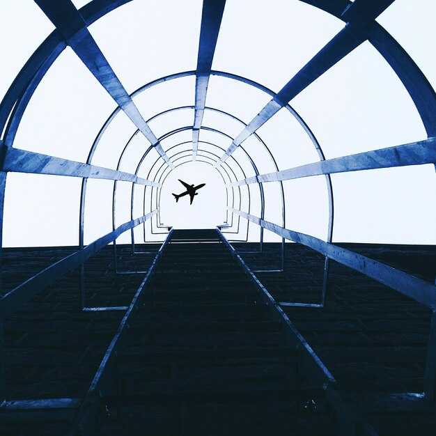
Adrenalin üçün SXM-dən başla: Princess Juliana Beynəlxalq Hava Limanı, burada uçuşlar Maho çimərliyinin düz üstündən keçir və tamaşaçılar kütlənin yaxınlıqdakı çimərliklərə dağıldığı zaman reaktiv axının təkanlarını hiss edirlər – 2025-ci ilin möhtəşəm enişlərinin açılış kadrı.
Ekspertlər həddindən artıq quraşdırmaları praktiki çıxışla tarazlaşdıran seçilmiş dəsti vurğulayırlar. Lukla, oturmuşdu. himalay dağın yamacında, dərə boyunca əsən səhər küləklərini qarşılayır. Paro Butanda dua bayraqlarla və məbəd təpələri ilə əhatə olunmuş vadi yanaşması təklif edir. Barra‘Şotlandiyadakı çimərlik uçuş-enmə zolağı yalnız alçaq qabarma pəncərələrini idarə edir, bu, heç vaxt unutmayacağınız bir teksturadır. İnnsbruck qar ilə örtülmüş zirvələrə doğru geri çəkilir, halbuki Funşal Maderada dəniz çiləyi ilə qayalıqları birləşdirən iplər dramatik bir gəliş üçün.
Səyahətçilər üçün yerli qabarmalar və küləklərlə pəncərələri planlaşdırın – Barranın qabarma cədvəli, Luklanın səhər termalları və Paronun dar vadi pəncərələri. Əgər sənədləşdirmə məhdud vaxt, iki istiqaməti birləşdirin: yüksək enerjili sahil qaçışı üçün SXM və İnnsbruck alp mənzərəsi üçün. Səyahət light çoxməntəşəli marşrutlar arasında mobil qalmağınıza kömək edir.
Bunda introduction 2025-ci il seçimlərinə ekspertlər praktik məsləhətlərini bölüşürlər: səhər saatlarına rezervasiya edin, qabarma cədvəllərini yoxlayın Barra, və külək xəbərdarlıqlarını izləyin. Dramın çox hissəsi saatlıq dəyişən küləyin istiqamətindən qaynaqlanır; qərbə doğru Uçuşlar çox vaxt Atlantik üzərində daha aydın mənzərələr təqdim edir, dağlara yaxınlaşma isə qəfil küləklərə hörmət tələb edir. Yenə də, mükafat heyranedici: hündürlüyü, sürəti və ətraf mənzərəni əks etdirən fotoşəkillər.
St Moritz Misal Nümunəsi: Engadin/Samedan Hava Limanı üçün Praktiki Eniş Təfərrüatları
Alplar üzərində sürprizlərlə qarşılaşmamaq üçün yanaşmanızı 3 dərəcəlik son ətrafında planlaşdırın və əvvəlcədən NOTAM-ları yoxlayın. Dəqiq şəkildə icra edildikdə, bu yanaşma ekipajlara təyyarəni ətrafdakı zirvələrdən yuxarıda saxlayaraq, kompakt uçuş-enmə zolağında eniş etməyə imkan verir.
Engadin/Samedanın uçuş-eniş zolağı təxminən 1800 metr uzunluğundadır və dəniz səviyyəsindən 1707 metr yüksəklikdə yerləşir ki, bu da mühərrikin işini zəiflədir və enmə performansına təsir edir. Son seqment sürətin diqqətlə idarə olunmasını, sabit konfiqurasiyanı və qısa uçuş-eniş zolağında təhlükəsiz enişi təmin etmək üçün 50 fut hündürlükdə qərar qəbul etməyi tələb edir.
Yükdaşıyıcılar və ramp işçiləri ilə yerüstü dəstəyi koordinasiya edin ki, baqaj və sərnişin axını hamar olsun. Londondan və ya İsveçdən gələn qonaqlar üçün eksklüziv transfer seçimləri və Engadin vadisinin irsini vurğulayan video brifinq təklif edin. Əvvəlcədən yerüstü marşrutları və işarələri təsdiqləyin ki, sərnişin axını sadə olsun, heç nə təsadüfə buraxılmasın və səyahətləri üçün premier gözləntilərinə cavab versin.
janeirosantos, maho, honig və pitkin kimi ekspertlər vurğulayırlar ki, ərazi uçuş-enmə zolağından yuxarı uzanır və uçuş göyərtəsi ilə darvaza arasında sıx koordinasiya tələb edir. Onlar tövsiyə edirlər ki, ən qısa dayanma məsafəsinə təsir edə biləcək həddindən artıq alovlanmanın qarşısını almaq üçün idarəetmələrdə sabit əl saxlanılsın; pilotlar uçuş-enmə zolağının mərkəz xəttini saxlaya, qanadları üfüqi vəziyyətdə tuta və alışmanı 20-30 futluq pəncərə daxilində dəqiq bir hərəkət kimi qəbul etməlidirlər.
| Item | Detail |
|---|---|
| Uçuş-enmə zolağının uzunluğu (metr) | Təxminən 1800 metr |
| Dəniz səviyyəsindən yüksəklik (metr) | 1707 metr |
| Səth | Asfalt |
| Yanaşma | Vizual seqmentli RNAV/GNSS; Son 3.0 dərəcəlik yol |
| Son hündürlük və klirens | 50 fut qərar hündürlüyü; 50 fut maneə boşluğu |
| Yerüstü xidmət | Baqaj üçün daşıyıcılar mövcuddur; əvvəlcədən təşkil edilmiş pandus dəstəyi |
| NOTAM yoxlamaları | Uçuşdan əvvəl yoxlayın; video təlimatını lazım olduqda yeniləyin |
| Sərnişin təcrübəsi | Eksklüziv transferlər; şəhərlərin London və İsveç vasitəsilə əlaqələri |
| Maliyyə | Yanacaq planlaşdırılması, heyət saatları və yerüstü xidmət haqları yüksək səviyyəli xidməti əks etdirir |
Uçuş-eniş zolağı və ətrafı: Qısa zolaq və dağ maneələri
Son yaxınlaşma: uçuş-enmə zolağının sertifikatlaşdırıldığından və gecə əməliyyatları üçün təchiz olunduğundan əmin olun, sonra kandarın arxasında yüksək ərazi olan qısa zolağa nəzarətli eniş edin. Dağlıq ərazilərdə küləklər sona yaxın dəyişir, kənarda təkanlar və sular yaranır; qapaqları əvvəldən konfiqurasiya edin və yəqin ki, eniş sürətinizi sıx bir həddə saxlayın. Vulcanair kimi təyyarələr üçün sakit havada yerə enin və hamar alov üçün yarım uzunluqlu marjadan istifadə edin. Laguardia üslublu kontekstlərdə tura və ya kurortlara uçuşdan əvvəl video brifinq keçirin və Honig qeydlərinə baxın. Səyahət edən heyət portyeleri hazır saxlamalı və işıqlar sönsə və ya ehtiyat uçuş-enmə zolağına ehtiyac olsa, kiçik bir bufer yaratmalıdır. Bu eniş həyəcanverici və öyrədici olaraq qalır, aviasiya azarkeşləri və təyyarə həvəskarları üçün aydın bir müalicə təklif edir. Əvvəlcədən planlaşdırın, irəlidəki ərazini qiymətləndirin və hər bir maneəyə sonda təhlükəsizliyi və dəqiqliyi artırmaq üçün praktiki bir işarə kimi yanaşın.
Hava Pəncərələri: Təhlükəsiz və Mənzərəli Yanaşmalar Üçün Ən Yaxşı Vaxtlar
Təhlükəsiz, mənzərəli yanaşmalar üçün yerli günəşin doğuşundan 1–2 saat sonra səhər pəncərəsini və ya gün batmazdan 1–2 saat əvvəl günortadan sonra pəncərəsini seçin ki, uçuş-enmə zolaqlarına və onların dramatik ətrafına panorama çıxışını maksimuma çatdırasınız. Cənnət mənzərələrini izləyən pilotlar üçün bu dövrlərdə işıq çox vaxt qayalıqlara və çay döngələrinə qarşı ən yaxşı siluetləri yaradır.
- Ümumi planlaşdırma hədləri: Hədəf küləkləri 5–18 knot, qəfil güclənmələr 25 knot-a qədər, görmə qabiliyyəti ən azı 8 km və VFR üçün bulud bazası 1800 metrdən yuxarı; mümkün olduqda 20 knot-dan yuxarı yan küləklərdən xüsusən də təyyarə hərəkətlərinin daha həssas olduğu qayalıqların üzərində qaçınmaq.
- Altiport mülahizələri: 1200 və 2500 metr yüksəklikləri arasında yerləşən yüksək hündürlüklü hava limanları performansı artırmaq üçün daha sərin hava tələb edir, lakin silsilələr yaxınlığında külək sürüşməsi sürətlə arta bilər. Sakit şəraitdən istifadə etmək üçün son yaxınlaşmaya günəşin doğuşundan sonra ilk işıq pəncərəsində başlayın, xüsusən də butan və ya digər alpin ərazilərində helikopter əməliyyatları və sabit qanadlı uçuşlar üçün.
- Uçurumlar və çay dəhlizləri: Uçurumlar uçuş-eniş zolağına yaxın yerləşdikdə və çay vadidən keçdikdə, enməni çayın istiqaməti ilə uyğunlaşdırın və uçuş-eniş zolağı boyunca sabit əks külək komponentindən istifadə edin; nəzarətli enişi və hamar son dönüşü təmin edin, panoramı görünüşdə saxlayın və onların hərəkətlərinin təhlükəsiz hədlər daxilində qalmasını və təhlükə zonalarından uzaq olmasını təmin edin.
- Regional notes: quito region operations require attention to local wind patterns; bhutan’s Paro valley demands precise timing; for scheduled destinations perched in high terrain, plan during the early morning window to gain access to the runway and the surrounding scenery.
- Operational tips: Verify METAR/TAF within 30 minutes of planned approach; if visibility dips below 8 km or wind shifts beyond 15 knots, switch to an alternate plan or hold in a safe pattern; for helicopter sorties, keep hover checks at the foot of the final approach path and adjust rotor movements to minimize exposure to near-surface turbulence; coordinate with air traffic control to manage movements of other aircraft near runways and their destinations.
Photography and viewing note: schedule flights for best light to capture the panorama and dramatic views toward the river bends and runways; ensure access for spectators remains away from the main path while offering clear sightlines to the destination.
Approach Options: ILS, Visual, and VFR Considerations at Samedan
Use the ILS approach whenever the weather allows. It locks you to the runway course and uses a glide slope to keep the descent inside the alpine bowl, reducing risk from view-blocking terrain and cliffs above the valley. If youre seated in the right seat, coordinate closely with the pilot monitoring to maintain the localizer and glide path; this configuration offers a stabilized hands-on approach until established on the final. This option has become the preferred way to accommodate high-altitude operations and probably provides the most reliable path through the stretch of peaks surrounding Samedan; saving fuel and time when conditions align.
Visual approaches work when weather and visibility are good. Keep your eyes on the runway, the foot of the valley, and the surrounding cliffs to maintain the correct track. If youre seated in the right seat, you may enjoy a clearer view of the touchdown zone and runway lights; rely on ATC to keep you aligned with the final course while avoiding view-blocking cloud banks that hug the slopes. The final segment remains tight, so fly a stable glide and adjust bank to stay on course. This option can also save time when traffic is buzzing in the valley from london-based and moritz-operated flights; british, dutch, and sweden crews often participate; also look for the approach lights and confirm position with navigation aids. If visibility drops, switch to ILS or RNAV to preserve a safe path.
Third option is VFR, provided weather remains in the VMC zone. File a VFR flight plan, maintain two-way radio contact with ATC, and keep cloud clearance and terrain separation. Stay above the foot of the mountains and use the valley corridors to reach the runway area; be ready to abandon the pattern if you encounter view-blocking conditions. british and dutch crews, along with sweden operators and london-based passenger flights to moritz, rely on VFR when winds are light and visibility is good; this option can accommodate quick arrivals, but you must have a clear horizon and be prepared to switch to an instrument approach if needed. источник reports that visibility and coordination are key for safe VFR use at Samedan.
Regardless of method, plan alternatives in advance, maintain continuous situational awareness, and keep the course tight around terrain features. The mountain backdrop stretches toward moritz and london corridors, and pilots frequently see a buzzing mix of traffic from british and dutch operators crossing the valley. By knowing when to switch between ILS, Visual, and VFR, you can save time while preserving safety and comfort for every passenger onboard.
Aircraft and Crew Prep: What Pilots Need to Know for St Moritz
Check density altitude and finalize your final approach plan before pushback; St Moritz’s Samedan airport sits high in the Engadin valley with mountains on all sides, so every decision hinges on altitude and winds.
- Environment and route specifics
- Altitude and terrain: Samedan lies about 1,700 m above sea level, with view-blocking peaks flanking the valley and a turquoise lake nearby. Those conditions demand precise navigation and a stabilized approach from the outset.
- Weather quirks: Expect wind shifts as mountain flows fill the valleys; gusts and rotor are possible near the final, especially in crossing wind regimes. Check METAR/TAF, then plan the approach to avoid last-minute surprises.
- Operational context: The stunning alpine environment requires constant scan of the terrain, and youre awareness of nearby routes to anticipate turbulence; keep eyes on the valley and lake while you navigate.
- Comparison note: Some crews find conditions similar to hawaii airports in terms of wind variability up high, but St Moritz presents a different density and mountain risk profile.
- Performance and configuration
- Weight and balance: Recalculate with half tanks of fuel if needed to improve climb performance and stopping margin on a short runway.
- Flaps and speeds: Use published landing flap setting and trim for the final; adjust approach speeds for altitude and temperature to maintain a safe margin to stall and ensure a clean flare.
- Power management: Maintain a smooth, shallow descent in the final; abrupt thrust changes degrade stability in the round, narrow valley corridor.
- Systems check: Confirm altitude alert, GP/RA indications, and terrain awareness have active mode on the approach path, especially with potential view-blocking terrain around the lake.
- Approach and navigation
- Approach plates: Load RNAV or partial NDB approach as published; configure autopilot to capture the vertical path early; hand-fly when required to maintain situational awareness in the valley.
- Altitude discipline: Stay high enough to clear the mountains if you encounter a late wind change; if visibility or instruction demands, execute the published missed approach rather than risk a late descent.
- Coordination and references: Maintain continuous radio contact with the Samedan tower; request valley cross and final approach sequencing as early as permitted; use Pitkin approach charts as a regional reference to verify the path. Descend within the minima allowed by the published approach plate.
- Ops, diversions, and travel context
- Alternate options: If winds prevent a safe landing, be prepared to divert to Bern, Zurich, or Lugano; know your alternates in advance and verify fuel and weather at those points.
- Connectivity: If youre travelling from toronto or madeira, plan connections to Samedan with time buffers for weather and alpine terrain transfers; those long hops make a single leg brittle in bad conditions.
- On-ground ops: Ground handling and de-ice checks take longer at high elevation; coordinate gate arrival, ramp, and de-icing with the host team to avoid holding in the valley corridor.
- Photo record: Capture a quick photo of the approach chart and final configuration for crew debriefs; the log helps when repeating or sharing tips with others in the tour network.
- General awareness and culture
- Known challenges: St Moritz sits among several snow-polished peaks; pilots who fly this route report zero-visibility risk in certain wind directions and emphasize stick-and-rudder discipline.
- Regional references: Compare to other demanding airports you know (queenstown, Madeira, Toronto-area airfields) to calibrate your expectations for ground congestion and weather variability, while respecting the unique Engadin topography.
- Team readiness: Seated in the left seat, the captain leads a tight crew in a short takeoff or landing; use a clear callout chain and cross-check with the FO and flight attendant team to manage passenger safety and tension in a high-stress environment.
Passenger Experience: What You’ll See and Feel on the Descent
Choose a right-side window seat and look toward downtown as you descend, especially in the morning. This angle gives you the clearest view of runways and city below, letting you time the moment with the cabin lights dimming and the engines easing into a gentle approach. For enthusiasts, this simple choice makes the experience eksklüziv və probably the best way to connect with aviation as it unfolds right above your seat.
From about 8,000 feet, the atlantic glints on one side while the downtown skyline rises on the other. The məşhur runway layout aligns with the coast, and view-blocking clouds can add drama, turning the moment into a spine-chilling scene as you tilt toward the higher final approach. According to pitkin and honig, calm hands and steady eyes maximize the payoff.
Inside, you feel the cabin pressure shift as the aircraft slows, a cool breeze brushing your arms, and the engines’ hum easing toward silence. The still air, whispered announcements, and the captain’s steady progress updates help you gauge time and distance to the runway; this moment will give you a vivid sense of proximity to the runway. Your hands grip the armrest, your eyes track the lights that guide you from above the city to the threshold below.
To maximize the moment, keep the window shade adjusted to reduce glare, stay seated until the captain signals, and avoid obstructing the view with bags. If you want the atlantic coast vibe, morning arrivals offer the best lighting for photos. The sertifikatlı crew will guide you through the final minutes, so you can savor the skyline without rushing.
After touchdown, the memory of the spine-chilling approach lingers while the downtown glow fades into morning bustle. Probably the most cinematic moment comes when dünyalar of aviation enthusiasts compare notes and share tips from pitkin and honig, along with the routes that carry you along the atlantic and toward the city’s skyline.