


Begin with knocknarea. This tall limestone dome near Sligo town rewards you with a 2–3 hour hike and a sweeping panorama. The climb is steady, the cairn at the summit offers a satisfying finish, and the paths fill the frame with sea, fields, and distant coast.
Next, the dingle coast delivers rugged climbs and wild Atlantic scenery. Hikes run from roughly 7–12 km, with spots where sea caves peek from the cliff base and waves crash along the rock shelves. The trails on dingle reward those who keep a steady pace, pack layers, and linger for photos at the edge of the world.
In the southeast, patrick features in local lore along the route near waterford, adding a touch of story to the hike. The approximately 8–11 km loop links forest paths and exposed meadows between hills and rivers, offering generous lookouts where you can fill your camera with coastlines and green fields. Youve got choices here to keep the trip light yet memorable, with times to pause for tea or photos as you please.
In Wicklow, Glendalough and surrounding ridges present shorter but fulfilling climbs. The hike winds through pine and birch, with rocky outcrops locals call hags that frame shots of loughs and valley depths. Expect well-marked paths, a steady ascent, and moments to linger for water and wind-swept views.
Plan ahead and check forecasts, especially for coastal options. The best times to hike are early morning or late afternoon when light softens the sea and fields. If youve got a day, pair a mountain stretch with a shoreline stroll to maximize spots for views and wildlife, and carry a map you can use offline in case signal drops.
Trail Details: Distances, Elevations, and Estimated Time for Each Route
Start with Slieve Donard in the Mournes for a solid introduction to your itineraries and stunning views. Distance: 11–12 km; Elevation: 730–750 m; Estimated time: 4–5 hours. The route follows a steady ascent from Donard Park to the summit, with a well-marked path and rocky sections near the top. This loop totals about 750 m of ascent; you can return the same way or add a woodland spur for variety. Driving to Newcastle is straightforward, and you’ll find villages along the approach roads; this route is a classic to put your stories into motion and to show why the Mournes are listed among Ireland’s best routes. Another option is to combine this with a short detour to nearby hills for a longer day, if your group seeks more challenge.
Next, Slieve Binnian via Hen and Chickens in the Mournes offers more dramatic scenery. Distance: 12–14 km; Elevation: 780–820 m; Estimated time: 5–6 hours. The route follows a high ridge, with dramatic cliff views over the southern Mournes and a rugged pass known to locals as the Hen and Chickens route. This one follows a tested track and has a total ascent around 800 m; start from a car park near Binnian and carry waterproofs for exposed sections. The outing is a favourite among those following longer itineraries and, along the way, you’ll pass through small villages where hikers swap stories about done days and routes others have tackled.
In Connemara, the benlettery circuit reveals a quieter gem. Distance: 9–11 km; Elevation: 550–600 m; Estimated time: 3–4.5 hours. The loop climbs grassy slopes to the benlettery summit and returns via stone-walled tracks, with views over the Twelve Bens and rivers below. Total ascent sits around 600 m; use a map in mist and plan a relaxed pace. Start near Lettermore, a true home base for exploring the western coast, where you can check weather and wind before the climb. This route is listed in several local guides as a standout for those seeking a less touristy part of the west coast.
The Cliffs of Moher Coastal Trail, County Clare, frames one of Ireland’s most iconic clifflines. Distance: 14–16 km; Elevation: 300–450 m; Estimated time: 4–5.5 hours. The route runs along the cliff edge with several lookout points toward Doolin and the Atlantic, so check wind, rain, and daylight. The total ascent is moderate, and parts of the path are exposed; a steady pace keeps the route comfortable. Driving from Galway City, head west along the coast to the Cliffs of Moher, where the scenery delivers stunning, camera-ready moments that are often featured in itineraries and stories about Ireland’s west coast. If you extend your day, you can add a visit to nearby villages along the broader coast, with your total experience growing beyond the listed distance.
Finally, the Spinc Loop in Wicklow offers a classic Dublin-area day hike. Distance: 7–9 km; Elevation: 420–520 m; Estimated time: 3–4 hours. The climb to Spinc follows a well-marked track above Glendalough’s lakes and returns along a lower trail, with views over the valley and the Wicklow Gap. Total ascent sits around 500 m; check weather and daylight, and plan parking in Laragh or at Glendalough. This route is a solid option that many city-dwellers have done, and it pairs well with other Wicklow options or a drive south to explore Wexford’s coast paths for another set of stunning scenery and villages along the way. Your day can flow from one part of the coast to another, following a mix of routes that fit your energy and time.
Mount Brandon Kerry: Route Options, Difficulty, and Key Waypoints
Begin at the Brandon village car park for the most direct ascent along the North Ridge. thats the quickest path to reach the height of about 950 m, with a divided progression: the beginning grassy slopes, a rocky mid-section, and the final scrambling across exposed ledges. The route is laid out in three stages, and its magnificent views unfold to the north. Many hikers have walked this route, and you’ll likely want to pause for photos. If the wind picks up, use the Foye Wood route for a sheltered escape through woodland to a saddle. This ireland hike offers a different perspective compared with the classic path. For a lighter option, bring pizza and spare layers; coming back, the road network near carrowteige provides a straightforward return if visibility holds. Another option exists via carrowteige for those who want a longer approach. You can test yourself on the final scrambling and enjoy the whole coastline scenery while you reflect on historical glimpses along the way.
Resvägsalternativ
- North Ridge from Brandon village car park – Classic route, 8–9 km round trip, 800–900 m ascent, typically 3–4 hours. The lower slope is grassy, then the ascent tightens with rocky sections; the final scrambling to the summit sits on exposed ledges. The route is divided into three stages and laid out for a steady cadence; you’ll find several standing cairns along the way. Parking is easy from the village road, and the whole ascent rewards with magnificent views to the north. If winds rise, shorten the route by descending via the saddle. Bring water, a compact energy snack (pizza works well), and a map so you can reach the high ground confidently.
- Foye Wood to Saddle – Starts with a woodland approach through Foye Wood, then climbs to a saddle below the peak. Distance 9–11 km, 700–850 m ascent, 3–4.5 hours. Quieter and sheltered, with occasional faint paths that require careful footing; offers historical glimpses in places and a calmer pace for those coming back after rain. This route provides an escape from the main crowds and a passage through varied terrain into open moorland.
- Coastal-Linked Carrowteige approach – Begins near carrowteige road, follows coastward tracks into inland uplands, then climbs to the summit. Distances 11–14 km, 900–1000 m ascent, 4.5–6 hours. Expect several exposed sections and panoramic views that justify the extra effort. This option is well suited for clear-weather days when visibility is excellent; it also offers chances to photograph the whole coastline and exposes hikers to the sea breeze. Be prepared for a longer descent along the road back toward the village.
Key Waypoints
- Brandon Village Car Park – starting point for the North Ridge and a common access point from the road.
- Foye Wood Gate – entry to the woodland approach; marked tracks lead into pine and birch stands.
- Woodland-to-Moorland Passage – where timber thins and the ground opens to moor, with cairns guiding the way.
- The Saddle (Col) below the final summit – major turning point for any route; from here the final push becomes exposed and may require scrambling.
- Summit of Mount Brandon – magnificent panorama of ireland’s rugged coast; note wind exposure and return route options.
- Carrowteige Road Crossing – descent or return leg for coastal circuits; makes a practical link back to the road network.
Iconic Vistas: Prime Viewpoints and Photo Opportunities on Each Trail
Begin at dromineer and climb the hill above the lake for the first frame–these early shots set the tone with calm water, distant ridges, and a sense of irelands untamed wilderness. These five hikes offer standout vistas where you can wander, pause, and capture images that tell a story beyond the guidebook.
Across these routes, plan for a handful of angles: low-perspective rock outcrops, elevated overlooks, and silhouettes of walkers against dramatic skies. Local walkers and couples often catch candid moments, so keep your camera ready as you pass traditional lanes, parks, and ridge edges ahead of crowded viewpoints.
| Trail | Iconic Viewpoint | Best Photo Angle | Practical Tip |
|---|---|---|---|
| Dromineer Loop | Lough Derg shoreline from the hill above Dromineer village, with reed beds and a calm surface | Low-angle shot along the shoreline to exaggerate the lake’s width; include a boat or mast for scale | Wear sturdy shoes; a small tripod helps in dawn light; bring a windproof layer |
| Gap of Dunloe Traverse | Ridge above the Gap of Dunloe, facing the purple-valley gorge and distant peaks | Stand on a cairn near the saddle and frame the valley ahead with the ridge lines converging | Prepare for uphill sections and longer day; keep a safe distance from edges; use a telephoto to compress depth |
| Cliffs of Moher Coastal Walk | Sea stacks and dramatic cliffs, with the Atlantic sweeping to the horizon; occasional sea caves along the base | Vertical panoramas from above the cliff edge; a medium-wide lens works well for sea stacks | Respect safety boundaries; avoid crowded moments at peak times; bring a rain cover and spare batteries |
| Howth Cliff Path | Baily Lighthouse and harbour views across Dublin Bay, with rugged coastline and rock shelves | Leading lines along the cliff path toward the lighthouse; a silhouette shot near sunset works well | Watch the wind; pack a compact tripod; a quick pose with a companion adds mass to the frame |
| Wicklow Way (Glendalough to Powerscourt vicinity) | Upper Lake overlook over pine slopes and glacial valleys; monastic ruins peeking through trees | Vidvinkel som inkluderar både sjö och dal; växla till en snävare bild för att isolera uråldrig stenkonstruktion | Gå ut tidigt för att fånga dimman; klä dig i lager; ett polarisationsfilter hjälper till att minska reflexer på vattenytor |
Dessa ramar sammanför traditionella kustbilder med inlandspanoraman – Kinsale Hill, Carlow Parks och andra böljande kullar – vilket ger dig alternativ för vidsträckta vyer och intima ögonblick. Lokalbefolkningen stannar ofta till vid åsen för att posera, så var beredd att fånga uppriktiga interaktioner; före de stora folkmassorna kan du säkra renare kompositioner. Om du bygger ett litet galleri, blanda bilder från de största klippväggarna med tystare reflektioner från Dromineer och Clew Caves i närliggande regioner; kontrasten kommer att förstärka känslan av Irlands mångsidiga utomhusarv. Förbered dig för uppförsbackar och väderomslag, och du kommer att återvända med en kompakt uppsättning bilder som berättar en komplett historia.
Praktisk tillgång: Parkering vid stigar, vägar och kollektivtrafik
Parkera på parkeringsplatsen närmast spårhuvudet; det avslutar fram-och-tillbaka-vandringen och snabbar upp din rutin efter vandringen genom att stanna här. Från denna punkt kan du starta rutten med en kort tur längs en tydligt markerad tillfartsväg. En lokal patrik delar med sig av korta berättelser om de bästa utsiktsplatserna längs höjdpunkterna; deras tips är populära bland erfarna vandrare.
Parkering och parkeringsplatser
Under högsäsong fylls den största parkeringen nära populära startpunkter tidigt; på helgerna anländer skaror av vandrare från platser som Wexford, Shannon och längre bort, så planera att anlända före soluppgången om du vill ha en plats. Skyltar pekar mot den officiella rutten och talar om hur du får tillgång till vägnätet, vilket minskar tiden du ägnar åt att vandra runt. Om en plats är full, flytta till nästa närliggande parkering snarare än att stanna på en vägren, vilket hjälper till att hålla trafiken flytande. Vissa leder tar ut en avgift för parkering efter en viss tid, så kontrollera de anslagna detaljerna vid grinden.
Anslutningsvägar och kollektivtrafik
Åtkomstvägarna är vanligtvis väl underhållna men smala på sina ställen; kör långsamt och lämna företräde till fotgängare vid övergångsställen. Den kortaste vägen leder dig till parkeringen och sedan vidare till starten med minimala omvägar. Höjdförändringar längs vägen är en del av upplevelsen och du kommer att se höjdpunkter kort efter att klättringen börjar. Där kollektivtrafik finns, ansluter tåg- eller bussförbindelser städer som fungerar som utgångspunkter för vandringarna; från huvudstaden ansluter tidtabellerna ganska bra till helgresor. I regioner som Wexford eller Shannon kan tjänsterna gå på specifika dagar med en rimligt prissatt biljett. Om du föredrar en heldag kan du kombinera en vandring med en kustaktivitet eller båttur och fortfarande återvända till din bas på kvällen.
Säsongsplanering: Väder, Kläder och Säkerhet för Irlands Vandringar
Packa alltid ett vattentätt skal med huva och ett varmt mellanlager, plus ett snabbtorkande baslager, och planera för tillräckligt med dagsljus för att avsluta en runda innan skymningen. För klättringar på Binnian eller Legnabrocky, bär en 20-30L ryggsäck, 2-3L vatten per person, energirika snacks, en pannlampa med extra batterier, en karta och kompass och en visselpipa. Iriskt väder växlar snabbt: våren och hösten ger 5-12°C med skurar; sommaren toppar runt 15-20°C men vinden på utsatta åsar kan kännas svalare; vintern ger 0-7°C med slask eller snö på bergstopparna. Börja före kl. 9 på vintern och försök att slutföra en runda, helst med lite marginal, för att undvika svagt ljus på klättringar nära vattendrag eller längs kuststräckor med en fyr. Om din plan går genom städer som Kinnitty eller längs Shannon-korridoren, kan du kombinera en stigning på en kulle med en promenad genom parker, men ha ett reservalternativ om sikten försämras eller lederna blir hala. Vissa sektioner nära städer är asfalterade, men majoriteten av terrängen förblir ojämn och fuktig, så ta med ordentligt grepp och torra strumpor–du kommer att tacka dig själv när vinden suger värme från exponerad hud och du fortfarande har tillräckligt med skydd.
Vad att packa
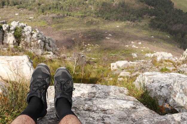
Underställ och ett skal som andas utgör basen. En handfull saker gör skillnaden: extra handskar, en mössa och ett lätt dunlager; rejäla vandringskängor med bra grepp; vattentätt regnskydd för att skydda packningen under våta dagar; 2-3 l vatten plus ett kompakt proviantlager; ett vattentätt kartfodral, kompass och visselpipa; pannlampa med extra batterier; solskyddsmedel och läppbalsam; ett litet första hjälpen-kit med skavsårsplåster; en nödfilt; och ett enkelt reparationskit (silvertejp, buntband). För kust- eller flodsträckor nära en stad med en fyr, överväg en vattentät påse för elektronik och ett par extra strumpor. Om du planerar en traditionell rundtur genom Binnian eller Legnabrocky på vintern, inkludera mikrospikar eller stegjärn och vandringsstavar för stabilitet. Tänk på att vissa turer tar längre tid än förväntat, så om prognoserna ändras kan du justera längs vägen utan att kompromissa med säkerheten.
Säsongsbetonade risker och säkerhet
Vädret kan växla under dagen: vinden på utsatta kullar överstiger ofta 40–60 km/h, med kyla som skär genom komforten. Innan avfärd, se över prognosen och dagsljuset; på vintern kan du ha ungefär 8–9 timmars användbart ljus, medan midsommaren ger 15+ timmar. Bäcköverfarter blir riskabla efter kraftigt regn; om en bäck sväller, gå tillbaka till en bro istället för att riskera att halka. Om du tappar leden, stanna, orientera dig med din karta, gå mot ett känt landmärke och gå tillbaka till den senast markerade punkten. Dela din rutt med någon i stan och ha en laddad telefon med offline-kartor ifall täckningen försvinner på högre stigningar som Torc eller längs åsar nära Shannon-mynningen. Söndagsvandringar i populära parker kan locka en handfull andra vandrare; anpassa takten därefter och respektera andra vandrare. En genomarbetad plan, särskilt för rutter genom Mourne-fotberget eller längs kuststigar, gör stor skillnad: du får förmodligen tillräckligt med självförtroende för att hantera en dag som tar dig från en udde vid havet till en utsiktsplats på en kulle.