

 اٹلی اور دنیا بھر میں زیر زمین شہر - تاریخ، فن تعمیر">

Plan a focused trip into Italy’s past by exploring Matera’s Sassi, where houses and churches are carved into rock and a network of undergrounds opens into thousands of caverns. Start here to see how dense spaces evolve into living quarters and public life, not just monuments.
In Matera and across southern Italy, architecture turns living space into geography. Orvieto’s tunnels and Naples’ Napoli Sotterranea reveal how cisterns, storage rooms, and corridors were layered over centuries. The walls themselves tell stories, with کھانے کا کمرہ niches and apartments arranged along winding galleries that kept households connected while reducing heat and humidity. A practical map helps readers visualize how daily routines fit into the rock.
A capuchin chapel in a carved chamber marks religious life below ground, while stone arches and vaults show careful engineering. The stop at each site spotlights how small rooms held tools, wine, and bread, echoing how communities shared scarce resources. This approach is practical for researchers and visitors who want to compare spaces across time.
Worldwide, undergrounds extend beyond Italy. In Cappadocia, Derinkuyu and Kaymakli stretch across multiple levels with winding tunnels, rooms, and workshops; thousands of spaces opened and repurposed over centuries. The architecture resembles a قلعہ carved from rock, with doors and ventilation shafts arranged to control air flow. A pedy inscription on a wall hints at local rituals, and a quiet dining hall shows how life organized meals in shared spaces. The experience is قابلِ ذکر for both examiners and curious travelers.
Data from wikimedia and field notes complement museum displays, offering plans, photos, and maps that opened paths to understanding. Across continents, some historians cite parallels in places as far as Kansas, showing how similar design ideas spread. It allows curators and educators able to compare sites side by side. For readers planning a global view, compare Matera, Naples, Orvieto, and Cappadocia with undergrounds in other regions, and consider the design lessons these spaces teach about ventilation, daylight, and crowd flows.
When you plan a visit, hire a licensed guide, respect fragile walls, and keep to designated passages. These spaces survive because visitors protect them; your awareness helps keep thousands of future visitors able to experience this subterranean heritage.
Outline for a Practical Guide to Underground Cities and Maze-Like Complexes
Start with three guided routes that fit several time pockets and fitness levels. For each route, plot niches, hidden spaces, and bunkers that a visitor can explore. Describe how past residents used shelters and how local communities protect secret spaces while welcoming responsible visitors.
Equip your kit: a headlamp, extra batteries, a map on waterproof paper, water, and a damp-proof notebook for notes. Include a compact cable to secure fragile panels if needed; capture the feel of different spaces and how sound echoes between chambers.
In france, Naours stands out as a well-preserved network of tunnels and chambers accessible to visitors with guided tours. In romanias, historians point to bunkers used during times of conflict, showing how communities adapted to stress. In australia, modern guides frame which spaces benefit from daylight and safe walking routes, making it a standout for visitors.
Outline how spaces connect: main chambers, side niches, and auxiliary tunnels, with emergency routes accessible via cable paths. The design should create a coherent visitor experience and support hubs that bring together residents and guides, including ones that reveal how spaces were used in the past.
Set safety rules: stay with a guided group, respect quiet zones, do not touch artifacts, and keep to marked paths. Assign a time limit per site and arrange a check-in for groups. Highlight that heritage should stay secret and preserved for future visitors and communities.
Content blueprint: the guide should present three core blocks – what to see, how to plan a visit, and what locals say about daily life in old shelters. Include checklists, maps, and image credits; for each site provide a short one-page summary with times, hours, and best seasons for visits.
Origins and Functions of Underground Urban Networks: Defense, Water, and Shelter
Start by tracing three linked systems: defense, water, and shelter, and map how they interlock across sites.
- Defense networks
- Carved corridors and vaults reinforced the first lines of defense, with hidden entrances that could be opened or sealed from within. These measures created a hierarchy of views–from street-level openings to inner galleries–that deter intruders while guiding residents to safety.
- Gates, watchposts, and small courtyards served as choke points for control and timing during sieges, keeping the same streets less accessible to attackers while preserving routes for escape or countermeasures. Local memories preserve the atmosphere of cautious patrols and witnessed marks on walls, which museum pieces now help interpret for visitors.
- In downtown quarters, such networks connected houses, workshops, and markets, enabling population groups to move under cover during threats. The discipline of layout–between chambers, stairs, and carved panels–offers a unique record of urban planning under pressure.
- Water systems
- Cisterns and gravity-fed conduits collected rainwater and captured groundwater, supplying residents during extended disruptions. Sites near coastal or hill country used the same basic principle: store water high in the system and release it along a controlled slope to homes and public fountains.
- Wells and siphons supported longer periods of habitation underground, while salt-related facilities hinted at nearby production and trade networks. The presence of such facilities often correlates with long-term occupation by a stable population and the reuse of older galleries for water transport.
- Engineering traces–stone inlet channels, carved archways, and watermarks on walls–reveal both technical skill and daily rhythms of life. Museums today display these elements as evidence of the urban habit of securing essential resources in all weather and seasonal conditions.
- Shelter and daily life
- Underground shelter spaces accommodated residents during sieges or extreme events, forming a resilient layer beneath the exposed streets. Such spaces often include living rooms, kitchens, and storage rooms aligned with the city’s circulation routes and markets.
- Houses and workshops could be clustered around main corridors, with smaller rooms carved into the rock for families, artisans, and traders. This arrangement supported a steady population and allowed shopping and daily routines to continue with minimal disruption.
- Over time, these networks accumulated layers of use–from military shelter to refuge during outbreaks, then to storage and even small production spaces for goods like textiles or foodstuffs. This evolution creates a lasting heritage that links local culture to wider regional trade and exchange patterns.
Across countries and centuries, such networks preserved a distinct atmosphere of endurance. In some regions, French chronicles and travelers noted how underground spaces shaped social life, while other sites document how merchants used corridors to move goods between markets and central squares–sometimes stretching into the edge of downtown and beyond to nearby markets or countryside routes.
Global comparisons show similar logic: low-cost shelter, controlled access, and strategic storage under urban cores. Longmen’s carved chambers and other worldwide sites demonstrate how subterranean design adapts to topography, climate, and material availability, while remaining anchored in the local heritage. When you study these networks, observe how production sites, salt stores, and living quarters sit next to each other, forming a unique continuum from shelter to daily commerce.
Practical takeaways for researchers and visitors:
- Map connections between defensive entrances, living spaces, and water distribution to understand the practical flow of daily life.
- Note the minimum clearances and turning radii in narrow passages to gauge how crowds moved in emergencies and how residents used small spaces for storage or work.
- Visit sites with museums and interpretive panels to compare carved inscriptions, wall marks, and restoration notes that witness the historical use of these networks.
- Consider how population size influenced design: larger centers near the country’s core required more extensive protection and water strategies, while smaller settlements relied on compact systems.
- Assess how heritage management preserves not just stones but the atmosphere of past communities, including market life, shopping routes, and social routines that linked subterranean spaces with the surface world.
- Look for evidence of production and trade: workshops, bread ovens, salt storage, and other economic functions that connected underground networks with above-ground life.
Architectural DNA of Subterranean Worlds: Tunnels, Chambers, Ventilation, and Cisterns
Begin with a focused route: start at an entry shaft, trace the tunnel into a main chamber, then follow the pathway to a cistern and the closest ventilation node. Take notes on partially preserved segments, the width in meters, and how spaces housed homes or workshops. During a weekend visit, compare two sites to see how builders solved air and water and how insights translate into modern planning into compact studies.
Tunnels and chambers feature stone arches, brick linings, and sometimes timber supports. Dimensions guide how people moved goods and performed daily tasks; many spaces housed homes, workshops, or storage, and artists left marks that reveal values and daily life, adding an intriguing layer to the architecture. The routes themselves demonstrate practical thinking as well as aesthetics.
Ventilation and cisterns form the core systems that let underground life endure. Vertical shafts move air across levels; wind-catchers channel breezes to deeper rooms. Cisterns store rainwater, feed gravity-flow networks, and provide water when surface sources lag. The methods show how spaces used themselves to survive.
Museums preserve the significance of these networks, and visitor centers and guided tours turn knowledge into memory. Tourist groups often crave these views. wikimedia entries offer diagrams and maps that help plan into detail and build a road map and a list of sites. This is a destination for researchers; england and turkey examples connect with chicagos archives explored by researchers. Caves and castles illustrate layered usage; preserved sections invite researchers to compare views from entry shafts to cistern floors.
Practical tips for readers: check site accessibility, wear sturdy shoes, bring a headlamp, and join guided tours to hear engineers explain ventilation shafts and water storage. If you plan multiple sites, build a road list that prioritizes well-preserved sections and museums where artifacts are housed, making a compact weekend itinerary.
اٹلی کے زیرِ زمین نمایاں مقامات: ناپولی سوٹرینیا، اوروییتو انڈر گراؤنڈ، متیرا ساسی
ناپولی سوتیرانیا سے آغاز کریں تاکہ اوپر نیپلز کی گلیوں اور نیچے سرنگوں کے پھیلاؤ کے درمیان فرق محسوس ہو۔ ان گیلریوں کو نرم ٹف میں تراشا گیا تھا اور انہوں نے محاصروں اور حملوں کے دوران پناہ گاہ کا کام کیا۔ گائیڈز اور اسکالرز کے ذریعے دریافت کیا گیا، یہ راستہ حوضوں، کنووں اور بنکروں کو جوڑتا ہے، ابتدائی تعمیر اور لوگوں کے اپنے لیے جگہ استعمال کرنے کے طریقے کو ظاہر کرتا ہے۔ ایک واحد کنواں اس نظام کو اینکر کرتا ہے۔ یہ سائٹ شہری تاریخ کے لیے اہمیت رکھتی ہے، یہ واضح کرتی ہے کہ کس طرح زیر زمین جگہوں نے اوپر کی زندگی کی عکاسی کی اور خطرات بڑھنے پر ایک محفوظ پناہ گاہ پیش کی۔.
اوروییتو زیرِ زمین، شہر کے چوک کے نیچے واقع ہے، جو گرجا گھر اور محلوں کے نیچے ہے۔ ٹُفا میں تراشی گئی اس میں غاریں، کنویں اور ایک پیچیدہ پانی کا نظام شامل ہے۔ محققین کی مہینوں کی تلاش سے یہ بات سامنے آتی ہے کہ باشندے ان جگہوں کو ذخیرہ کرنے اور پناہ لینے کے لیے کیسے استعمال کرتے تھے، تعمیراتی مراحل شہر کی لچک کی عکاسی کرتے ہیں۔ امکان ہے کہ سرنگوں کا ایک حصہ شہر کے مرکز کے نیچے تک پھیਲਾ ہوا ہے۔.
متیرا ساسی चूने के पत्थर की चट्टानों पर स्थित है और गुफा आवासों की एक अनूठी, स्तरित बस्ती प्रस्तुत करता है। सदियों से, लोगों ने चट्टान में निर्माण किया, जिससे कमरों, सीढ़ियों और शांत आंगनों का एक नेटवर्क बन गया। आज, यूनेस्को इसे इसके महत्व और घरों के दैनिक जीवन की कहानी बताने के तरीके के लिए मान्यता देता है। आगंतुक संकरी गलियों का पता लगाते हैं, अक्सर प्राचीन दीवारों के साथ आधुनिक जीवन की सुखद झलकियाँ पाते हैं। एक कार्यालय प्रभाव को कम करने के लिए पर्यटन का समन्वय करता है, जबकि व्यापक इतिहास वास्तुकला में दिखाई देता है।.
یہ تین جگہیں دکھاتی ہیں کہ زیرِ زمین جگہیں کس طرح منفرد ہو سکتی ہیں، پناہ، تعلیم اور ایک مقام کا احساس پیش کرتی ہیں جو آج بھی زندہ ہے۔ دن بھر کی تلاش کے بعد، قریبی ایک خوشگوار بیئر اس بات پر غور کرنے میں مدد کرتی ہے کہ وہاں کیا گزری ہوگی۔ واشنگٹن کے محققین اور عجائب گھر ماڈلز اور آرکائیوز کے ساتھ تحفظ کی حمایت کرتے ہیں، جبکہ برگسٹڈٹفیسٹ جیسے واقعات ان کمیونٹیز کی بازگشت ہیں جو ثقافت کے لیے زیرِ زمین جگہوں کو دوبارہ استعمال کرتی ہیں۔.
یورپ کے سات ڈراؤنے بھول بھلیاں جن کا آپ دورہ کر سکتے ہیں: کلیدی مقامات، رسائی اور دورے کے لیے تجاویز
پیرس کے قبرستانوں سے شروعات کریں تاکہ زیرِ زمین نیٹ ورکس نے ایک شہر کو کیسے تشکیل دیا، اس کا پہلا اور واضح احساس حاصل ہو: یہ سابقہ پتھروں کی کانیں ہیں جو وسیع راستوں اور کمروں میں تبدیل ہو گئی ہیں جو 18 ویں صدی کی شہری منصوبہ بندی کی اہمیت کو ظاہر کرتی ہیں، جہاں کوئی بھی گائیڈڈ ٹور میں شامل ہو سکتا ہے یہ دیکھنے کے لیے کہ یہ کہاں لے جائے گا۔.
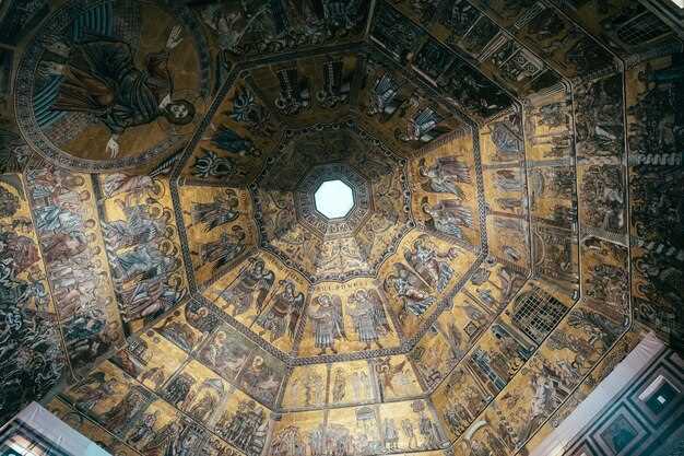
ویلیچکا نمک کی کان (پولینڈ) زائرین کو گہرائی میں سطح کے نیچے تراشے گئے ایک سابقہ کان کنی کمپلیکس میں مدعو کرتی ہے۔ یہاں ہزاروں نمک کے چیمبر راہداریوں، چیپلوں اور زیرِ زمین جھیلوں کا ایک وسیع نیٹ ورک بناتے ہیں، جن کی موٹی دیواریں ہوا کو گرم رکھتی ہیں۔ گائیڈڈ راستے سینٹ کنگا چیپل، ایک زیرِ زمین کھانے کا علاقہ، اور نمک سے تراشے گئے مجسمے دکھاتے ہیں، جو سب سائٹ کی اہمیت کو ظاہر کرتے ہیں۔ یہ کان 13ویں صدی کی ہے اور ہر سال تقریباً دس لاکھ زائرین آتے ہیں۔ ٹور تقریباً دو گھنٹے تک جاری رہتا ہے، جس کے کچھ حصے وہیل چیئرز کے لیے قابل رسائی ہیں اور دوسروں میں سیڑھیوں کی ضرورت ہوتی ہے۔ اپنے وقت کو زیادہ سے زیادہ کرنے کے لیے، شولڈر سیزن کے دوران صبح کے وقت بکنگ کروائیں جب رش کم ہو، اور حصوں کے درمیان وقفے کا منصوبہ بنائیں تاکہ یہ اندازہ لگایا جا سکے کہ نمک کس طرح ٹھنڈے دنوں میں بھی ہوا کو آرام دہ رکھتا ہے۔.
ایڈنبرا والٹس سکاٹ لینڈ کے ساؤتھ برج کے محرابوں کے اندر واقع ہے، جہاں صرف گائیڈڈ ٹور کے ذریعے جایا جا سکتا ہے۔ راستے پرانے زیرِ زمین جگہوں سے گزرتے ہیں جو کبھی کارکنوں اور تاجروں کے لیے گھر، گودام اور ملاقات کی جگہیں ہوا کرتے تھے، جس سے آپ کو اس بات کا اندازہ ہوتا ہے کہ شہر کے نیچے زندگی کس طرح جاری تھی۔ گائیڈ پل کے نیچے بنی تہوں کی وضاحت کرتے ہیں، اور ایسی کہانیاں سناتے ہیں جو تاریخ کو توہم پرستی کے ساتھ ملاتی ہیں۔ ایک ٹارچ اور گرم کپڑے لائیں– سرنگیں سال بھر ٹھنڈی رہتی ہیں۔ یہ تجربہ ظاہر کرتا ہے کہ شہر ان پوشیدہ جگہوں کے ارد گرد کیسے بڑھے، اور اگر آپ واشنگٹن یا کنساس سے آ رہے ہیں، تو قریبی قلعوں، پبوں اور عجائب گھروں کا ایک ہی سفر میں مزہ لینے کے لیے اس اسٹاپ کو یوکے کے ایک طویل سفر میں شامل کریں۔.
پوسٹوجنا غار (سلووینیا) 24 کلومیٹر کے نظام میں 4 کلومیٹر کا سیاحتی راستہ پیش کرتا ہے، جس میں غار نما ہالوں کے قلب میں ایک چھوٹی ٹرین کی سواری شامل ہے۔ گائیڈز دیوہیکل سائز کے غاروں اور کیتھیڈرل جیسے ہال کی نشاندہی کرتے ہیں، جن میں اسٹیشنوں کے درمیان لکڑی کے پل اور اوپر موٹے اسٹالیکٹائٹس ہیں۔ یہ جگہ ایک محفوظ، خاندانی دوستانہ دورہ فراہم کرتی ہے، اور سطح پر ایک کیفے اترنے کے بعد آپ کو کھانے کا موقع فراہم کرتا ہے۔ چڑھائی میں سیڑھیاں کم ہیں اور یہ زیادہ تر صلاحیتوں کے حامل افراد کے لیے موزوں ہے، لیکن مضبوط جوتے پہنیں۔ پوسٹوجنا سارا سال کھلا رہتا ہے، اور پیک سیزن میں راستہ اکثر فروخت ہو جاتا ہے، اس لیے پہلے سے بکنگ کرنا دانشمندی ہے۔.
Škocjan Caves (سلووینیا) ایک UNESCO سائٹ ہے جو دریائے ریکا کے ذریعے تراشے گئے ایک وسیع زیرِ زمین گھاٹی کے لیے مشہور ہے۔ اس نیٹ ورک کو صرف گائیڈڈ ٹورز پر دریافت کیا جاتا ہے، جن کے راستے لکڑی کے پلوں کے ساتھ اور بڑے غاروں میں سے گزرتے ہیں جو کسی گرجا گھر کی طرح محسوس ہوتے ہیں۔ یہ ٹریل وزیٹر سینٹر سے شروع ہوتی ہے اور اس میں سیڑھیوں اور ہموار بورڈواک کا ایک مرکب شامل ہے، جسے نازک کارسٹ زمین کی تزئین پر اثرات کو کم سے کم کرنے کے لیے ڈیزائن کیا گیا ہے۔ ٹھنڈے، مرطوب ماحول اور ہلکی، فعال دریافت کے کئی گھنٹوں کی توقع رکھیں جب آپ سطح کے نیچے دریا کے شاندار راستے کا پتہ لگاتے ہیں۔.
وسطی اٹلی میں واقع اورویٹو انڈر گراؤنڈ، قرون وسطی کے مرکز کے نیچے پوشیدہ ٹوفو چٹان میں تراشے گئے شہر کے وسیع غاروں کے نیٹ ورک کو ظاہر کرتا ہے۔ یہ راستے شہر کے عین قلب میں چلتے ہیں، جن میں ذخیرے، کنویں اور کمرے بنے ہوئے ہیں جو مقامی لوگوں نے صدیوں سے استعمال کیے ہیں۔ کچھ خصوصیات 13ویں صدی کی ہیں، اور روایات میں پرڈیڈا کا ذکر ہے، جو ایک تنگ راستہ ہے جس کے بارے میں کہا جاتا ہے کہ اسے بھولبلییا میں بغیر کسی نشان کے حرکت کرنے کے لیے استعمال کیا جاتا تھا۔ سطح پر ایک خارجی راستہ آپ کو واپس اورویٹو کی سنگریزوں والی گلیوں میں لے جاتا ہے، جس سے مرکزی چوک میں فوری واپسی اور اترنے کے بعد مقامی خصوصیات، شراب اور جیلاٹو کو چکھنے کا موقع ملتا ہے۔.
انگلینڈ کے سومرسیٹ میں چیڈر گورج کی غاریں زیرِ زمین بھول بھلیوں کا ایک مختصر اور آسان تعارف پیش کرتی ہیں۔ یہاں کی غاروں کے دوروں میں تنگ سرنگوں، کُشادہ غاروں اور چونے کے پتھر سے بنی موٹی چھت کو عبور کیا جاتا ہے جو گرم موسم میں بھی پُرسکون رہتی ہے۔ گائیڈ پرانی کان کنی کے کارناموں کے بارے میں بتاتے ہیں اور اس بات کا جائزہ لیتے ہیں کہ غاروں نے مقامی روایات اور صنعت کو کیسے تشکیل دیا۔ اس کے ساتھ ہی گورج کے اوپر چٹانوں پر پیدل چلیں یا قریبی فارموں اور پَب کا رُخ کریں تاکہ دن بھر کی سیر و تفریح کا اختتام کیا جا سکے۔.
ہدایات برائے ملاقات: منصوبہ بندی، ٹکٹس، ٹورز، اوقات، رسائی، فوٹو گرافی اور تحفظ کے آداب
داخلے کی ضمانت کے لیے اور لائنیں چھوڑنے کے لیے وقت مقررہ آن لائن ٹکٹ بک کریں۔.
ایک عملی دن کی منصوبہ بندی کریں: کھولنے کے اوقات اور موسم کی تصدیق کریں، اور نوٹ کریں کہ بہت سی زیرِ زمین سائٹس گلی کی سطح سے نیچے واقع ہیں۔ چونے کے پتھر سے بنے راستوں اور چیمبروں کے وسیع نیٹ ورکس ایک دلچسپ زیرِ زمین دنیا کو ظاہر کرتے ہیں اور انہیں دفاع، گزرگاہوں، چیپلوں اور مندروں پر زور دینے والے منظم ٹورز کے ذریعے دریافت کیا جا سکتا ہے۔ پتھر کی دیواروں کے پیچھے آباد کاری کے نمونے اس بات کی ایک جھلک پیش کرتے ہیں کہ کس طرح کمیونٹیز زیرِ زمین جگہ استعمال کرتی تھیں۔.
ٹکٹ اور ٹور: ٹکٹ کے اختیارات جگہ کے لحاظ سے مختلف ہوتے ہیں۔ بعض عجائب گھر اور زیرِ زمین مراکز مشترکہ پاس پیش کرتے ہیں، جبکہ دیگر کو الگ اندراج کی ضرورت ہوتی ہے۔ اپنی دلچسپیوں کے مطابق انتخاب کریں اور گائیڈڈ ٹور پہلے سے بک کروائیں۔ گائیڈز مقامی آپریٹرز کے ذریعے ترتیب دیئے جاتے ہیں اور وہ بستیوں کے کھنڈرات، پتھروں سے تراشے گئے ہال اور اہم راستوں کو نمایاں کرتے ہیں۔ مزید تنوع کے لیے، برگسٹڈٹ فیسٹ جیسے مقامی تہوار کے ساتھ سیر کو جوڑنے پر غور کریں۔.
وقت اور موسم کے اعتبارات: موسم کے حساب سے وقت مختلف ہوتا ہے اور آخری اندراج کا وقت اسی کے مطابق بدلتا ہے۔ گرمیوں میں ٹھنڈے اوقات میں پہنچنے کا منصوبہ بنائیں اور سیکورٹی چیک کے لیے وقت نکالیں۔ زیرِ زمین منظر اور درجہ حرارت مستحکم رہتا ہے لیکن سطح پر موسم رسائی کے راستوں پر اثر انداز ہو سکتا ہے۔.
رسائی: بہت سے راستوں میں سیڑھیاں ہیں۔ کچھ سائٹس پر لفٹ تک رسائی یا ڈھلوان راہداریاں موجود ہیں۔ وہیل چیئر کے موافق آپشنز کی تصدیق کے لیے پہلے سے آپریٹرز سے رابطہ کریں، اور ایسی سائٹس تلاش کریں جو مصروف اوقات میں متبادل راستے فراہم کرتی ہیں۔ پولینڈ، روس، ترکی اور ٹسکنی میں، اختیارات مقام کے لحاظ سے مختلف ہوتے ہیں۔.
مقامات اور مراکز: زیرزمین اکثر شہر کے مراکز یا قدیم بستیوں کے قلب میں جمع ہوتے ہیں۔ کچھ شہری مراکز مختصر راستوں سے جڑے ہوئے ہیں، جبکہ دیگر وسیع نیٹ ورکس ہیں جن میں متعدد داخلے ہیں۔ اگر آپ اپنی سمجھ کو وسیع کرنا چاہتے ہیں تو ایسے شہروں کو تلاش کریں جو تاریخی سیاق و سباق کو جدید زندگی کے ساتھ جوڑتے ہیں۔ برگسٹاڈٹ فیسٹ طرز کے واقعات کبھی کبھار ثقافتی پرت شامل کرنے کے لیے دوروں کے ساتھ ہوتے ہیں۔.
تصویر کشی اور احتیاطی آداب: تصویر کشی کی پالیسیاں سائٹ کے لحاظ سے مختلف ہوتی ہیں؛ عام ہالوں میں بغیر فلیش تصویر کشی عام ہے، جبکہ چیپلوں اور مندروں کے اندرونی حصوں میں فلیش اور تپائیوں پر اکثر پابندی ہوتی ہے۔ اشاروں کا احترام کریں، گزرتے ہوئے ٹریفک کو مسدود کرنے سے گریز کریں، اور پتھر سے تراشی ہوئی سطحوں یا نوادرات کو مت چھوئیں۔ نشان زدہ راستوں پر رہ کر اور حساس علاقوں کے قریب کھانے سے گریز کرتے ہوئے ماحول کو محفوظ رکھیں۔ احتیاطی عمل میں نقصان کی اطلاع دینا اور چونے کے پتھر کے وسیع کمپلیکس کی مسلسل دیکھ بھال میں مدد کے لیے عملے کی رہنمائی پر عمل کرنا شامل ہے۔.
| پہلو | Guidance |
|---|---|
| Tickets | آن لائن وقت کے سلاٹ؛ جہاں پیشکش کی گئی وہاں کمبو پاس؛ ڈسکاؤنٹس اور فیملی آپشنز تلاش کریں؛ جو فٹ ہو ان میں سے ایک ریزرو کریں۔. |
| ٹورز | مقامی آپریٹرز کے ذریعے گائیڈڈ آپشنز ترتیب دیے گئے ہیں۔ چھوٹے گروپس رسائی کو بہتر بناتے ہیں اور پتھروں سے تراشے گئے راستوں، چیپلوں اور دفاعی خصوصیات پر توجہ مرکوز کرتے ہیں۔. |
| اوقات کار | موسمی تغیرات؛ آخری اندراج کے اوقات کے لیے منصوبہ بندی کریں؛ بندش سے بچنے کے لیے پیشگی تصدیق کریں۔. |
| رسائی | بعض راستوں میں سیڑھیاں ہیں؛ ایلیویٹر تک رسائی یا قابل رسائی حصے تلاش کریں؛ ضرورت پڑنے پر پہلے سے انتظام کریں۔. |
| Photography | عموماً بغیر فلیش کی اجازت ہے؛ چیپلوں اور مندر کے اندرونی حصوں میں فلیش اور تپائیوں پر پابندی ہے؛ براہ کرم علامات کی جانچ پڑتال کریں۔. |
| تحفظ آداب | نشان زدہ راستوں پر رہیں؛ پتھر سے تراشیدہ سطحوں کو مت چھوئیں؛ حساس علاقوں کے قریب کھانا نہ لائیں؛ نقصان کی اطلاع عملے کو دیں۔. |
| مقام اور سیاق و سباق | شہری مراکز اور تاریخی بستیوں پر محیط سائٹس؛ پولینڈ، روس، ترکی، ٹسکنی اور اس سے آگے مختلف مراکز اور رابطے شامل ہیں۔. |