

 10 ההרים הגבוהים בעולם – המדריך האולטימטיבי לפסגות הגבוהות ביותר של כדור הארץ">
Begin with אוורסט כבסיס לתכנון שלך, מכיוון שהוא מגדיר גובה רב יותר, מסלולים ראשיים ואת הלוגיסטיקה ששומרת על בטיחות המטפסים. כשאתה מתכונן, נעל סט של מיומנויות ליבה ומסלול טיול גמיש שמאפשר לך להסתגל במהירות למזג האוויר ולשטח.
הרשימה שלהלן מציגה את 10 ההרים המובילים עם הגבהים שלהם ו טווחים, מפסגות ההימלאיה ועד הקרקורם: אוורסט (8848 מ', הרי ההימלאיה), K2 (8611 מ', קרקוראם), קנגצ'נג'ונגה (8586 מ', הרי ההימלאיה), לוֹטְסֶה (8516 מ', הרי ההימלאיה), מקאלו (8485 מ', הרי ההימלאיה), צ'ו אויו (8188 מ', הרי ההימלאיה), דהאולגירי (8167 מ', הרי ההימלאיה), מנאסלו (8163 מ', הרי ההימלאיה), נַנְגָה פַּרְבַּט (8126 מ', הרי ההימלאיה), אנאפורנה I (8091 מ', הרי ההימלאיה).
עבור מטפס הרים, נתונים אלה מתורגמים לצעדים מעשיים: בחירת מקום אימונים ליד מחנות בסיס, פיתוח שלבי הסתגלות לגובה, ותרגול טכניקות חבלים, מכיוון שכל טיפוס בוחן את הנחישות האיתנה ואת הריכוז שלכם בקור עז. טווחי הגובה מצריכים קצב זהיר כדי להימנע מקשיים ולנהל את מרווחי החזרה כדי לסייע לגוף שלכם להסתגל במהירות.
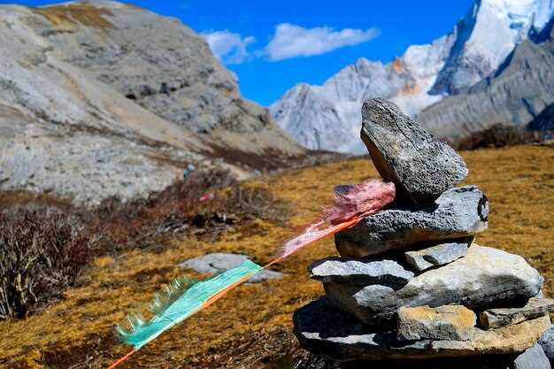
מטיילים ומטפסים שאפתנים שואלים לעתים קרובות מה מייחד את המקומות האלה. אלן, מדריך מנוסה, מסביר שהכריזמה של הפסגות הגבוהות ביותר משחקת עם אור – קרח, סלע וצל – אך המבחן האמיתי טמון בהתמודדות עם הקשיים שתפגשו במחנות בדרך. מטפסים מסוימים מתו בעבר בגלל מפולות שלגים או סופות פתאומיות; הסיפורים שלהם מעצבים את התוכן ומניעים קבלת החלטות טובה יותר עבור צוותים וטיפוסים סולו כאחד.
בין אם אתם מטיילים כמטיילים המחפשים חדש מקום או כמטפס השואף לשיא אישי, גשו לכל עלייה במשמעת וסקרנות. תכננו מסלולים עם שותפים, שמרו את הרשומות שלכם קרוב, כבדו תנאים מקומיים, ושימו לב כיצד עמק יכול להציף בעננים ולסנוור מהקרחונים אגמים בסביבה. אתה יכול חזור מטיפוס חזק יותר טכנית ואופינית, מוכן לחלוק תוכן עם אחרים שקוראים את הרשימות שלך וצופים בסיפורים שלך.
הדירוג של אוורסט בין עשרת המובילים וההשלכות שלו
דרג את האוורסט במקום הראשון והדגש את השלכותיו על תכנון, פרוטוקולי בטיחות וניהול תיירות. במבט חטוף, האוורסט הוא מספר אחד ברוב המקורות עבור עשרת הפסגות המובילות, מעמד אשר משפיע על היתרים, רשתות מדריכים ומוכנות לחילוץ. altezza שלו עומד על 8,848 מטרים, כפי שאושר על ידי נתונים סטטיסטיים ממקורות מרובים, אשר מחזקים את תפקידו כפסגה הבולטת ביותר של כדור הארץ. קוראים אשר מעוניינים בתצוגה מציאותית ישוו את הפרופיל שלו למסלולים באלפמאיו ובקמצ'טקה כדי לראות הבדלים במסלולים ובחשיפה.
מבחינה מעשית, הדירוג של האוורסט מתורגם ליותר אימונים, יותר ציוד ויותר תכנון מגירה. הקור, האוויר הדליל והגובה הקיצוני יוצרים קושי ניכר למטפסים ולמדריכים כאחד. צוותים חייבים לנווט בין חלונות צפופים, שינויי מזג אוויר ולוגיסטיקה, תוך איזון בין סיכון להזדמנות. החלטות נואשות צצות לעיתים כאשר חלונות מזג האוויר נסגרים, ולכן משמעת באתר ונהלי חירום ברורים חשובים. באזורים סלעיים ליד מחנות הבסיס, תצורות בראק דורשות עבודת חבלים זהירה, ומעברי נהרות בעמקים מרוחקים עשויים לדרוש שימוש בקאנו כדי להגיע לאזורי ההיערכות.
סטטיסטיקות ממקורות שונים מראות אלפי ניסיונות בכל עונה, כאשר ההשתתפות מגיעה לשיא בתקופות נוחות ומשתנה בהתאם לאזור. כיום, קובעי מדיניות ואנשי שימור מקשרים את הבולטות של האוורסט לתפיסות תיירותיות רחבות יותר ברמה הפלנטרית, ומַנְעים בקרות היתרים קפדניות יותר ואמצעי הגנה סביבתיים. דמותו של האוורסט בשקיעה לעיתים קרובות מציתה את העניין הציבורי, אך הנתונים שומרים על הדיון מבוסס על סיכון, צפיפות ושימוש במשאבים. נרטיבים בולטים עולים מדיווחים מהשטח והדיאלוג המתמשך בין מדריכים, סבלים ומטפסים לגבי שימור הגישה לדורות הבאים.
רוצים תוכנית תמציתית לקוראים השוקלים את האוורסט מול פסגות אחרות? השוואות מאוחרות יותר עם האלפמאיו ממחישות כיצד גבהים, דפוסי מזג אוויר ושטח שונים משפיעים על קושי וקצב. השתמשו ברשימת תיוג פשוטה: אמת נתוני גובה ממקורות מהימנים, סקרו תנאים מקומיים והעריכו את הכושר ואת ציר הזמן של ההתאקלמות שלכם. חשוב מכך, תכננו חלון צעידה מציאותי, הזמינו תאריכים גמישים והתכוננו ללילות קרים ולרוחות חזקות. אם אתם רוצים לחקור כיצד הדרגה של האוורסט מעצבת את הפרקטיקה, התחילו במבט חטוף בתמונת מחנה הבסיס, ולאחר מכן למדו את המסלולים, הלוגיסטיקה ורשתות הבטיחות לפני שאתם מתחייבים לטיול רגלי או למסלול הרים רחב יותר היום.
חלונות טיפוס אידיאליים לאוורסט ולפסגות סמוכות
תכננו טיפוסים לאוורסט בשני חלונות זמן מצומצמים: מאמצע אפריל ועד סוף מאי, ומסוף ספטמבר ועד אמצע אוקטובר. תקופות אלה מספקות את האיזון הטוב ביותר בין אור יום, אוויר יציב בגובה רב וסיכון נמוך יותר לסערות, מה שמשפר משמעותית את הסיכויים שלכם על האוורסט ועל פסגות סמוכות כמו לוטסה, נופטסה, פומורי וצ'ו אויו. בעוד שמונסון הקיץ מגיע לאזור, הנתיבים העליונים עדיין מציעים חלונות זמן, אך הראות עלולה לרדת ומזג האוויר עלול להשתנות בתוך שעות. השטח כולל קירות קרח דרמטיים, והרקע של פסגות נישאות מוסיף כריזמה מדהימה למטפסים שמקפידים על לוח זמנים ממושמע.
יסודות מזג האוויר: בחלונות הזמן האלה, זרם הסילון זז מהפסגה, מסלולי הסערה נרגעים, ומערכות לחץ גבוה שולטות למשך תקופות ארוכות יותר. צפו לבקרים בהירים, זריחת שמש עולה, וכיסוי עננים נמוך יותר מעל 6,000 מטרים. יום טוב טיפוסי מציע 10–14 שעות אור יום שמישות לדחיפה לפסגה. הרוחות בפסגה נשארות ניתנות לניהול ברוב הימים, אבל משב רוח בודד יכול לשבור מסלול; שימו לב לעננים שנסוגים וחושפים את הטווח האמיתי של ההר.
ישנם שלושה חלקים בתכנון לניהול לוח זמנים: רצף עלייה, התאקלמות או רוטציה וימי חירום. הגורם המרכזי הוא זמן: אתם צריכים לפחות 2–3 שבועות מעל מחנה הבסיס כדי להסתגל, עם חלון של 7–10 ימים סביב הטיפוס לפסגה; אם תחמיצו גשם או רוח, אתם עלולים להפסיד יום, יומיים או ארבעה ימים. הבחירה של ימים מצומצמת יותר ממה שזה נראה; אתם עשויים לקבל רק 3–5 ימים אופטימליים בחלון הזדמנויות.
סיכונים ותמותה: גם בתזמון טוב, המסלול טומן בחובו סיכון לתמותה; מפולות שלגים, סדקים קרחוניים וסופות פתאומיות גבו חיים רבים, ומותם מדגיש את הצורך בתכנון שמרני, קווי תקשורת ברורים וקבלת החלטות קפדנית. הקפידו להתאים את הקצב ולסגת אם התנאים יתדרדרו.
פסגות סמוכות חולקות את אותו מחזור חיים: לוטסה ונופצה עוקבות אחר הקצב של האוורסט, קאלה פאטאר מציעה תצפית על אותה תפאורת מזג אוויר, ואלפמאיו בהרי האנדים מדגימה כיצד אקלים שונה מעצב חלון. העיקרון נותר: תכננו סביב רצף ימים יציב עם מינימום עננים ורוח נוחה כדי למקסם את ההצלחה ולמזער את הסיכון.
הקשר בין צמחייה וגובה: מחנות הבסיס מארחים צמחייה אלפינית מוגבלת באזורים הנמוכים, בעוד שמחנות גבוהים יותר מציגים פחות מאפייני צמחייה וחשיפה גדולה יותר לרוח ולקור. הסביבה האלפינית שולטת, ולכן מטפסים מסתמכים על מכשור, הסתגלות והקפדה על קצב ולא על צמחייה כסימן לתנאים טובים. לכן חלון הזדמנויות מתוזמן היטב חשוב כהערה מעשית לכל משלחת.
רשימת סגירה: אסוף מבחר מקורות תחזיות, עקוב אחר עדכוני לוויין, ושמור על גמישות בתוכנית שלך. אל תרדוף אחרי לוח זמנים בלתי אפשרי; הקצה ימי חיץ לשינויי מזג אוויר ועננים שצצים במהירות אחרי בוקר בהיר. בקיץ, שינויים מהירים עלולים לכווץ יום פוטנציאלי לכלום, לכן שמור על חלקים בתוכנית שלך מוכנים להפעלה או לביטול לפי הצורך.
Gear you need for high-altitude climbs on these mountains
Equip a layered system: a three-layer shell, a warm midlayer, and a compressible insulation layer. Use a shell with a helmet-compatible hood, pit zips, and reinforced cuffs. A puffy or down jacket with approximately 800–900 fill power provides warmth in camps or belays. Pair with windproof gloves, a balaclava, and a warm hat. This setup has been found to improve protection and energy management on trips in the Karakoram, Eiger, and Dolomites, and the result is higher comfort in variable weather. While you plan, you can adjust quickly as conditions shift, without carrying extra bulk.
Technically, the same pieces cover higher altitudes, but you add or drop layers as you ascend. On routes above 5,000 meters, you may need a heavier down layer; in the Dolomites or other alpine areas, you might manage with lighter options. From coaching notes and field data, you’ll want to keep the core warm while maintaining dexterity for hands and feet.
Clothing and warmth
- Boots: insulated, crampon-compatible, 1–2 sizes larger than daily wear to fit thick socks; choose a stiff sole for stability on ice.
- Socks: two pairs per boot, wool or synthetic; use a liner sock to reduce blisters.
- Base layers: lightweight merino or synthetic tops and bottoms; avoid cotton.
- Midlayers: fleece or lightweight down; choose a compressible option to save pack space.
- Shell: three-layer waterproof/breathable jacket and pants; ensure a long cut behind the knees to keep snow out when you crouch or kneel.
- Gloves: a thin liner, a midweight insulated glove, and a heavy-duty hardshell mitten; add hand warmers when stationary at altitude.
- Headwear: balaclava, sun cap, and warm hat; choose high-visibility colors for dawn or dusk.
- Gaiters: knee-high waterproof gaiters to keep snow and scree out of boots.
Climbing and safety gear
- Helmet: lightweight, ice-tool compatible with a secure fit; check certification.
- Harness, rope, carabiners, slings: plan for belays in tougher sections; use a dynamic rope roughly 50–70 meters in length depending on approach.
- Ice axe: long enough to reach the snow when you stand tall; consider a model with an integrated leash.
- Crampons: ensure compatibility with boots and adjust fit before leaving base; keep anti-balling plates or tech spikes on dry days.
- Oxygen system: optional for some routes above 7,000 meters; if you choose it, practice assembly with a guide; carry spare parts and a mouthpiece.
- Navigation and safety: headlamp with extra batteries, map, compass, altimeter; whistle; personal locator beacon if you are off-track.
alan, a local guide frequently mentioned around Eiger routes and in Argentina’s high Andes, emphasizes resting periods and pacing. This approach helps maintain energy–you’ll return with strength to tackle higher sections and improve the overall result. For coastal-influenced weather zones near the Dolomites, carry a compact wind shell and keep hydration steady, since dehydration accelerates fatigue at altitude. If you want to optimize weight, choose multi-use items and test gear on a shorter trip before attempting a longer ascent. Each piece serves a purpose, and the right combination keeps you safer on every area you climb, from the classic granite faces to the glaciated routes atop the Karakoram. Found gear combinations like these consistently perform well, and you’ll notice a unique confidence when you move smoothly through cold air and high wind. Return to camp with gear that held up under pressure, and you’ll be set for the next ascent–whether you’re chasing a new route in Argentina or revisiting familiar lines from the Eiger to the Dolomites.
Acclimatization, safety practices, and risk mitigation
Limit daily altitude gain to 300–500 meters above 3,000 meters and insert a rest day after every 1,000–1,500 meters.
Plan acclimatization cycles into your itinerary. The body adapts mainly during rest at altitude, not while pushing hard, so a patient schedule reduces the risk of AMS and injury. technically, adaptation occurs during rest periods, while climbing can quickly exhaust resources. Before the trip, train your cardio and leg strength; a solid base increases endurance and speeds acclimatization. For example, allocate 10–14 days for exposure above 4,000 meters, and extend by several days for objectives like Makalu. On northern or western routes, you still gain experience with gradual ascents and lower camps first. A seven-step approach helps organize the process: hydrate well, eat regularly, sleep enough, pace climbs, monitor symptoms, check weather and avalanche risk, and keep a clear descent plan. The path toward snow-capped camps yields stunning views and the wonder of the planet’s highest peaks, and each acclimatization cycle builds resilience. This approach has a long history among expedition teams. This plan gives climbers confidence to push when the moment is right, ever mindful of limits. It is part of a safety plan that avoids the hype of rush-filled blog posts and keeps the focus on measured progress. It increases the climber’s confidence and reduces the risk of overdue challenges. This method works for every place climbers target, from northern icefields to Kamchatka’s volcanic zones. It also raises awareness of huge demands on the body and under high altitude stress, fatigue accumulates quickly and pacing becomes critical.
Acclimatization protocol
Base at 2,000–2,600 meters; day trips to 3,000–3,500 meters; sleep at or below 3,000 meters after each trip; repeat once or twice to form a rotation before attempting higher camps. In Makalu’s system you might perform three cycles, then push to higher camps only after a full rest day at the previous height. Track body signals such as fatigue, headache, nausea, and appetite; if AMS symptoms appear, descend immediately and reassess. Hydration stays at about 3–4 liters daily; avoid dehydration by sipping regularly and balancing electrolytes. If you use a pulse oximeter, aim for resting saturation around 88–92% at altitude; use supplemental oxygen only under a medical plan and local guidance. This training and planning increases confidence and reduces the chance of a late-night scramble on a snow-capped ridge. Kamchatka training grounds offer brutal terrain that builds balance and endurance without the crowd pressure of busy routes.
Safety practices and risk mitigation
Establish a buddy system and pre-agreed turnaround times; never press on with unresolved symptoms. Climbs in western ranges or northern camps demand rope discipline, fixed-line checks, and proper harness use; inspect gear daily and replace damaged items. Carry a compact first-aid kit, a reliable communication device, and a clear descent plan; rehearse it with your team before leaving base. In crowded camps, respect space and avoid elbowing others in queues or tight corridors. Weather windows decide success, so check forecasts, monitor wind, precipitation, and temperature swings; do not start a move if a storm is forecast within the next 24–48 hours. For extra safety, choose a plan that includes a contingency for rapid descent and a supported rescue option; this reduces the risk when conditions deteriorate or unforeseen challenges arise.
Budget, permits, and planning tips for a multi-peak trip
Secure permits 6–12 months ahead and budget per-peak fees to roughly 40–60% of your total cost. Pick a regional corridor to minimize border checks and travel time. A picturesque option pairs a peak like blanc with washington to reduce flights and keep the plan cohesive; changes in policy can occur, so verify details before booking. Some routes require special access, and keeping a flexible approach significantly improves your odds of a successful crossing of high passes. The whole itinerary should feel unique, with snowy alpine scenery and lakes at base camps. Some hikes between major ascents help legs recover and views stay fresh. The massif Blanc (often written as blanc in guides) demands attention to seasonal limits and entrance rules; plan around those to avoid last-minute disruptions and ensure exceptional scenery when you reach the summits.
היתרים ותזמון
washington: The region generally allows day-hike access with park rules; no dedicated climbing permit is required for most routes, but conditions vary by season. blanc: The massif Blanc (often written as blanc in guides) requires park entry and car passes during peak season; secure 6–9 months ahead to avoid capacity limits. lhotse: routes in the high Himalaya demand coordination with national authorities and licensed operators; permits are typically arranged 9–12 months ahead, with acclimatization days and buffer dates. brakk: border zones and remote terrain require careful planning and local authorizations; start approvals well in advance to absorb potential delays. maestri: weather windows are narrow and local permissions can shift; plan around storms and long-range forecasts. To reduce elbowing through queues and streamline processing, book guides who handle border procedures and permit filings. Some permits require letters of invitation or visa arrangements; maintain a contact list and confirm changes regularly. Aiming to climb a tenth peak in a sequence is feasible if you prioritize logistics and allow extra days for delays. You should also incorporate some hikes to keep your pace balanced.
| שיא | Permit window (months ahead) | Permit price range (USD) | הערות |
|---|---|---|---|
| washington | 3–6 | 0–75 | No routine climbing permit; check park rules |
| blanc | 6–9 | 0–60 | Parc entry; car passes; peak-season crowding |
| lhotse | 9–12 | 300–1200 | Nepal permissions; licensed operator; acclimatization |
| brakk | 9–12 | 500–1500 | Border logistics; weather risk; expedition setup |
| maestri | 6–12 | 200–600 | Local permissions; weather variability; remote access |
To keep the plan efficient, locate base camps located near lakes and picturesque valleys to maximize rest days and views. Elbowing through busy trailheads becomes avoidable with pre-arranged guides. The tenth peak in the sequence is feasible if you pair a short acclimatization block with a light hiking day beforehand. A plan conducted by experienced maestri teams keeps logistics tight and reduces last-minute changes, making the overall itinerary more manageable. Keeping the approach focused on safety and a few key ascents yields a unique, memorable experience across varied terrains.
Budgeting and logistics
Estimate the baseline cost: permits, guides, porters, flights, gear, and contingency. For a two- to four-peak plan, allocate 15–25% of your budget to contingency and emergency insurance. Book with operators offering bundled permits and guiding to save time and avoid miscommunications. Keep gear lean and modular; a lightweight system improves mobility and reduces hotel and transport costs. Check local transport pricing and shuttle routes a few months in advance to prevent unexpected rises. Build in a 20–30% buffer on overall travel duration to absorb weather delays. In snowy routes, verify avalanche forecasts and carry a compact safety kit; lake crossings can freeze or thaw, so schedule windows with stable conditions.