


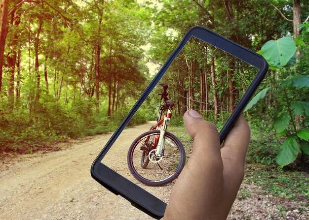
Choose a 25–40 mile hybrid loop this weekend to kick off your cycling season. Begin with a route that blends urban streets and quiet greenways, roughly 25–40 miles, to maximize safety and enjoyment. This configuration lets you sample different surfaces and city textures through a single ride while maintaining a comfortable pace. Inclusions like water, snacks, lights, and a compact repair kit ensure the ride is seamless from the first mile to the finish. If you are still deciding, compare two options that pass through distinct neighborhoods, exploring different view and vibe.
Use a world-class planner to map elevation, surface types, and traffic patterns. Look for routes that flow through urban cores and green corridors, with the least steep climbs and several flat sections for a smooth transition. Inclusions such as coffee stops, restrooms, and bike-friendly cafes matter for comfort. In reality, short, well-planned loops deliver confidence faster. Observe the city’s architecture as you pass bridges and plazas to gauge safety and aesthetics.
Top routes to consider include riverfront loops, urban-center circuits, and rail-trail segments that connect parks and waterfronts. Each option offers world-class scenery and varying surfaces to suit a hybrid bike. If you’re an enthusiast, seek routes with a few extra hills or longer flats to test pacing. Plan for weather shifts, wind direction, and potential detours due to construction. Choose routes with manageable traffic and good surface quality for a steady rhythm.
Finalize your pick by saving a primary option and a backup; download offline maps and share your plan with a friend. Use your planner to slot the ride into your calendar and attach a simple checklist: lights, spare tube, patch kit, pump, and multitool. After the ride, log distance, average speed, elevation gain, and surface mix to refine future picks and improve your planning view.
Quebec by bike: best routes, planning steps, and practical tips
Begin with this actionable move: plan a two-week loop that pairs the Petit-Train-du-Nord trail (about 232 km from St-Jérôme to Mont-Laurier) with the historic Chemin du Roy along the St. Lawrence for a balanced mix of forested trails, river towns, and cultural stops. The rail trail offers paved sections, gentle grades, and friendly access to cafés and bike-friendly inns in each community. Plan 60–70 km every day on the rail path, leaving room for detours to Sainte-Adèle, Val-Morin, and Labelle. For the Chemin du Roy, ride in segments between Quebec City and Trois-Rivières, or onward toward Montreal, with daily legs of 40–100 km depending on your pace. Bring a repair kit, spare inner tube, and a power bank for GPS and timing; this turnkey combo delivers world-class mileage and a canadian corridor that suits avid riders.
Expand your route set with the Véloroute des Bleuets around Lac Saint-Jean for a north–south arc featuring farmland, forests, and lakeside towns such as Alma, Roberval, and Desbiens. Distances vary by chosen segments, but most riders plan 50–90 km days and stay in lodging or camping spots along the way. The route connects to existing routes in Saguenay–Lac-Saint-Jean and links to the Route Verte network, offering multiple adventure options throughout the region. If coastal winds appeal, add the Véloroute de la Gaspésie for sea views and lighthouse stops; plan carefully here, as weather can shift quickly. Inquire with local bike shops for current surface conditions and refill points, and use official cycling websites for updates.
Planning steps you can apply right away: map each day with a clear destination, book accommodations near town centers on the provincial tourism website, and keep a few backup options in case a segment fills up. Build a daily rhythm that balances steady riding with short rest breaks, especially in hot weather. Use a modeled route network and rotate between paved and chip-seal sections to keep bikes happy. Stay mindful of the weather window; Quebec summers are generally pleasant, though coastal and river sections can see sudden changes. For gear, pack a lightweight rain shell, puncture-resistant tires, a compact pump, and a basic first-aid kit; a phone with offline maps reduces anxiety if signals dip. Also bring spare tubes and a multitool for both bikes.
On the road, choose busy routes when possible and keep a safe distance on rural roads; shoulder space can be narrow, so stay visible with bright clothing and lights at dawn or dusk. Have a friendly plan for daily meals, with canadian-friendly cafes ready to stamp a simple ‘ride’ log on your day. Carry a water bottle and electrolyte mix, and refill as you go; most towns along the routes offer markets and bike shops that welcome riders and provide quick fixes. Carry a small emergency card and a photo of your insurance card; this activity stays smooth when you prepare for contingencies and minimize risk.
Stories from avid riders provide practical insights and adventures; swipe through the website for informative reports and ride logs that explain terrain, elevation, and wind patterns. Across the routes, you’ll find world-class views, river outlooks, and friendly locals sharing tips and local history. The exploration here is well documented, with best-season advice, lodging pacing, and kid-friendly segments for families. If you want a tailored plan, inquire with a local guide or a municipal tourism office to shape an itinerary that fits your pace and available days.
To maximize value, include every planned stop and avoid backtracking by using verified itineraries; this helps ensure you cover iconic segments without fatigue. For gear, a pannier system or light rack bag keeps equipment tidy, while a spare chain link and multitool saves time on the road. For etiquette, greet fellow riders, yield on narrow stretches, and respect wildlife zones along lakes and forests. Finally, log your adventures and insights on social feeds or a personal blog; the stories you collect along Quebec’s roads throughout can inspire every canadian rider and curious traveler.
Must-ride Quebec routes: distance, elevation, and highlights
Kick off with the Mont-Tremblant circuit: 68 km, 980 m of elevation gain, a great balance of forest climbs and lake descents that keep you engaged from mile-end cafés to the summit. Expect mount-style climbs that test the legs. When exploring Quebec by bike, participate in an agency-run day that offers insights into the course and the plateau above. This option suits adults seeking a solid workout with rewarding views.
Below is a sample selection of must-ride routes, each with distance, elevation, and key highlights to help you plan. Each route showcases varied terrain and scenery.
| المسار | المسافة (كم) | Elevation gain (m) | Highlights |
|---|---|---|---|
| 68 | 980 | lake views, forest climbs, switchbacks on the plateau | |
| Charlevoix coastal ride | 92 | 1,180 | sea cliffs, lighthouse, rolling climbs above the river |
| Mile-End to Mont-Royal urban climb | 26 | 320 | historic Mile-End streets, waterfront paths, city parks |
| mybackroadstrip in Eastern Townships | 120 | 1,650 | vineyards, farm lanes, overlooks above the valley |
These routes use well-maintained roads, and a good guide package can include turn-by-turn notes, safety tips, and waypoint markers to keep you on track throughout the ride.
once you finish, you’ll want to plan another loop.
Seasonal planning for Quebec cycling: weather, daylight, and trail access
Plan your season with a selected list of routes and a trusted, detailed guide, prioritizing daylight windows and trail access restrictions for quebec, canada, and montreal.
Winter in quebec brings cold and snow: daytime highs around -5 to -15 C near montreal, with wind chills dipping lower; ice forms on shaded forest trails and mud persists into late spring; use underground training on a rollers setup when weather locks you out, and stock drinks for hydration.
Spring and fall offer milder days but variable conditions; daylight grows in late spring, delivering great views along rivers and forest edges; near montreal and quebec networks, start rides early to catch cooler temps and moderate levels of heat, and enjoy the variety.
Trail access shifts with seasons: snow cover blocks several loops; after thaw, mud creates slick patches and some routes have restrictions; stay on marked paths, with networks based in montreal and quebec, and consider beyond-city trails where winter closures are lighter; some routes are ship-accessible via river ports, expanding options, and free parking near trailheads may help.
Equipment matters: titanium frames stay light and resist corrosion in winter grime; pair with wider tires for spring gravel; pack detailed tools and a spare tube; keep outdoor layers and a hydration plan with drinks.
Europe and america influence regional choices; quebec’s network blends europe-inspired gravel with canada-based routes, delivering engaging and varied scenery; plan routes near montreal to enjoy skyline views and skyscrapers and then deeper forest lanes.
Refund options exist if weather cancels; check terms when booking tours, and plan with a deeper approach to protect your choice and enjoyment.
Navigation and comfort: maps, GPX files, and turn-by-turn planning
Load a turnkey GPX package for your route onto your bike computer or phone, then enable turn-by-turn navigation and offline maps. This setup keeps you moving with comfort and confidence from the first mile.
- Maps and offline access: load region maps for offline use; vector maps give spacious detail and fast zoom, conserving data.
- GPX quality: verify the file contains waypoints, elevation, and turn instructions; test a short segment to confirm accuracy; theyre detailed and current.
- Turn-by-turn planning: set bold prompts for critical turns; customize font size and audio; ensure road names appear clearly on the display.
- Comfort and ergonomics: mount at eye level, adjust grip or bar mount, test screen brightness; hold the device steady and keep controls glove-friendly.
- Group rides and safety: share the GPX bundle with your group; mark regroup points and hydration stops; agree on signals and pace in advance.
- Locations and convenience: pre-load stops like george cafe, parks, repair shops; check hours and permitted parking; choose routes that minimize congestion.
- adaptability: pick routes with alternatives if weather or road work appears; keep a backup file on cloud; youve got quick detours ready.
- Transportation integration: plan connections to transit to start or finish segments; include car-share stops or train stations in notes.
- market options and world-class detail: rely on map sets that show elevation, surface type, and pavement condition; select locations with reliable coverage and clear labeling.
- Safety-centric prompts: enable alert tones for sharp turns, steep descents, and restricted roads; review local signage and rules for the area.
If conditions change, you can switch to a ready backup route quickly.
Practical gear and safety checklist: bike setup, helmets, lights, and packing list
Start with a detailed bike setup: adjust saddle height for a slight knee bend, align fore-aft so the knee tracks over the pedal axle, and dial in a comfortable reach that matches your frame geometry. The built-in brake and tire checks should confirm crisp engagement and proper tread, and tires should be inflated to the sidewall range (roughly 4.5–6.0 bar for road, 2.0–3.5 bar for wider tires). Do a 5–10 minute test ride to capture any pressure points or numbness, and revisit the setup when you add new shoes, pedals, or a different wheel size, especially on long days of riding. Keep a compact tool kit with you until you finish the day.
Helmet fit matters: choose a CE-certified helmet that sits level on your head, with straps snug under the chin and a dial or pads that secure the shell. Replace after any crash or if the foam shows compression or cracks. Keep a spare strap kit. If you ride accompanied by kids, theyre comfortable and secure, and adjust for aged riders as well.
Lights are the rule for visibility: mount a front light that reveals the road ahead and a rear light for traffic awareness. Fronts in the 400–1000 lumen range work well in most urban and rural settings; carry a backup battery or a small power bank. Check mounts so lights stay aimed on the road, test in daylight, and swap to brighter settings for longer days. If you ride with others, use daytime running lights to help them see you.
Packing list: spare tube, patch kit, tire levers, a mini-pump or CO2 cartridge, a multi-tool, and chain lube. Include a small first-aid kit, ID, cash or card, and a charged phone with offline maps. Bring water and snacks such as nuts and cheeses, plus a compact blanket or layer for rest stops. For family rides include kid-sized gear, a lightweight rain shell, and a few activities to capture stories while exploring different habitat areas or parks. Pack a sample of favorite items and rotate them on selected days; use market visits to check availability of replacements via online shops. A compact pack that fits under the seat or on a rack keeps everything accessible.
Route planning tips: assess the course for different terrain and habitat, and plan rest breaks around parks or beaches. If your itinerary includes snorkeling or water stops, bring a dry bag and a lightweight towel. When traveling with kids or aged riders, pace the route and allow time for stories, photo stops, and small explorations. Visit local guides or online forums for updated availability and sample routes, and capture notes for future trips.
From route to itinerary: sample 3-, 4-, and 7-day plans with daily breakdowns
Start with a 4-day plan to balance pace and rest; this sample shows detailed daily legs, additional buffer, and a data-backed approach you can build on. The routes traverse citys and rural lanes, with known scenic stops and fresh meal options. The plan assumes minimum gear and a simple package of support options. If you have a package booked, accommodations, bike shops, and route notes appear in one app, ready for your ride.
3-day plan: Day 1. Begin in a canadian city outskirts and ride 60–70 km through lake country and rolling farmland. Maintain a pace around 22–25 km/h, with a 20-minute lunch break and a longer stop to enjoy a view. Include a coffee stop and water refill at a village market; finish at a cozy inn for a comfortable night.
3-day plan: Day 2. Push to 70–85 km with two gentle climbs totaling 300–500 m. The route winds between shorelines and orchards, with a mid-day pause for a fresh pastry in a roadside bakery. If you cross a rail line, you may pass a short underground passage, staying on calm, bike-friendly streets. Use data from local maps to adapt pace for wind and road quality.
3-day plan: Day 3. Return loop of 40–60 km back toward base, or shuttle back by train. Finish by early afternoon, with a final coffee stop and a visit to a small market. Have a booked hotel waiting, ensuring a smooth end to the run and room to recharge before the next plan.
4-day plan: Day 1. Start at a scenic trailhead, riding 55–70 km through quiet lanes and forest lanes. Include a lunch at a riverside café and a couple of photo breaks. Build in a longer rest near a lookout and a fresh dinner in town. This segment uses known shoulders and bike-friendly detours to keep the initial pace comfortable.
4-day plan: Day 2. Cover 65–75 km with modest climbs and a mid-day pause for a market snack. Between town hops, stay flexible for dynamic wind and surface changes. A short segment may run alongside a rail corridor, with underground crossings kept to a minimum for safety and flow.
4-day plan: Day 3. A loop of 60–75 km that threads through village greens and orchards, with a longer lunch in a historic square. Include a couple of scenic detours to keep things fresh and allow for additional photos or local tastings. Data-backed route notes help you avoid restrictions on road works or closures.
4-day plan: Day 4. Final 40–60 km leg to return near the origin. Wrap up with a relaxed pace, a light training session, and a cool-down ride along a canal or shore. Aiming for a minimum daily target keeps the plan realistic while still offering enough time for sightseeing and a final phase of packing and rest.
7-day plan: Day 1. Start in a city with easy access to surrounding lanes and a clear route through rural hamlets. Ride 50–65 km at a comfortable pace while you test gear at a roadside shop and collect any data on surface quality. Booked accommodations ensure you don’t waste time searching after sunset.
7-day plan: Day 2. Move 60–70 km through gentle hills, with a stop for fresh coffee and pastry. Between towns, you’ll pass fields and small forests; keep an eye on restrictions, and plan an extra 15–20 minutes for a longer lunch if the weather shifts.
7-day plan: Day 3. Extend to 70–85 km, weaving through citys outskirts and riverside paths. A deeper detour to a market town gives you a sense of local life and an opportunity to refill water and snacks. Pace should stay steady to avoid fatigue across the longer leg.
7-day plan: Day 4. A day of moderate distance, 60–75 km, with several scenic viewpoints. Include a châteaux detour if you’re traveling through a wine region, enjoying mid-day tastings and a relaxed lunch. This stretch emphasizes flexible timing and a few extra stops for photos and snacks.
7-day plan: Day 5. Push 50–65 km toward a mid-point base, letting the route dip between farmland and urban corridors. You’ll likely encounter underground passages near a larger town; use them to shorten city traffic while keeping the pace comfortable.
7-day plan: Day 6. Cover 60–75 km with another mix of rural lanes and canal paths. The dynamic weather may require a short route adjustment; have an additional backup loop in mind and a plan to shorten if needed.
7-day plan: Day 7. Final 40–55 km leg to finish at a comfortable endpoint. Reflect on what you learned, download the data for future rides, and consider a fresh booking option for a new route later. This longer run gives you a deeper feel for pacing, terrain, and regional flavors, while keeping your experience guaranteed to stay enjoyable and rewarding.